

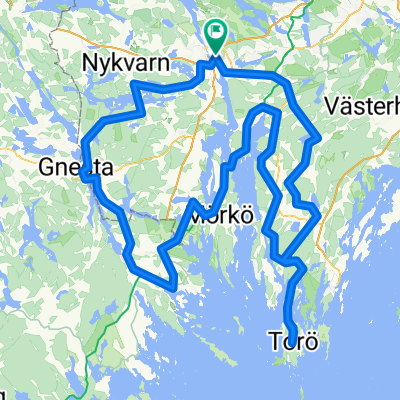
ostsee20-15 Södertälje - Trosa
A cycling route starting in Södertälje, Stockholm County, Sweden.
Overview
About this route
ostsee20
vordere Etappe: ostsee20-14 Stockholm - Södertälje
Variante zu dieser Etappe: ostsee20-15v Södertälje - Trosa
nächste Etappe: ostsee20-16 Trosa - Nyköping
- -:--
- Duration
- 39.4 km
- Distance
- 365 m
- Ascent
- 365 m
- Descent
- ---
- Avg. speed
- ---
- Avg. speed

Route quality
Waytypes & surfaces along the route
Waytypes
Busy road
19.9 km
(51 %)
Cycleway
7.3 km
(19 %)
Surfaces
Paved
31.5 km
(80 %)
Asphalt
31.4 km
(80 %)
Paving stones
0.1 km
(<1 %)
Continue with Bikemap
Use, edit, or download this cycling route
You would like to ride ostsee20-15 Södertälje - Trosa or customize it for your own trip? Here is what you can do with this Bikemap route:
Free features
- Save this route as favorite or in collections
- Copy & plan your own version of this route
- Sync your route with Garmin or Wahoo
Premium features
Free trial for 3 days, or one-time payment. More about Bikemap Premium.
- Navigate this route on iOS & Android
- Export a GPX / KML file of this route
- Create your custom printout (try it for free)
- Download this route for offline navigation
Discover more Premium features.
Get Bikemap PremiumFrom our community
Other popular routes starting in Södertälje
 Kakslottet
- Distance
- 25.4 km
- Ascent
- 299 m
- Descent
- 326 m
- Location
- Södertälje, Stockholm County, Sweden
 Mälaren Runt - etapp 2 - 18okt,2023
- Distance
- 68 km
- Ascent
- 25 m
- Descent
- 25 m
- Location
- Södertälje, Stockholm County, Sweden
 rando2
- Distance
- 205.7 km
- Ascent
- 452 m
- Descent
- 452 m
- Location
- Södertälje, Stockholm County, Sweden
 Södertälje Cycling
- Distance
- 27.5 km
- Ascent
- 345 m
- Descent
- 350 m
- Location
- Södertälje, Stockholm County, Sweden
 season opening
- Distance
- 33.8 km
- Ascent
- 456 m
- Descent
- 457 m
- Location
- Södertälje, Stockholm County, Sweden
 ostsee20-15 Södertälje - Trosa
- Distance
- 39.4 km
- Ascent
- 365 m
- Descent
- 365 m
- Location
- Södertälje, Stockholm County, Sweden
 Sandviken to Lurberget viewpoint
- Distance
- 10.8 km
- Ascent
- 161 m
- Descent
- 154 m
- Location
- Södertälje, Stockholm County, Sweden
 Södertälje - Örebro Dag 1: Södertälje - Eklången
- Distance
- 72 km
- Ascent
- 805 m
- Descent
- 799 m
- Location
- Södertälje, Stockholm County, Sweden
Open it in the app