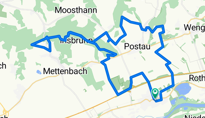


Wörth-Kronwieden-Dornwang-Buchteith-Breitenau-Hofdorf-Vogelsang-Mühlhausen-Hösacker-Veitsbuch-Moosberg-Postau-Wörth
- 34.9 km
- 332 m
- 332 m
- Wörth an der Isar, Bavaria, Germany
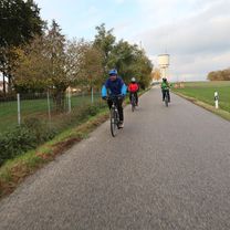
Mountainbike-Touren um Wörth
A cycling route starting in Wörth an der Isar, Bavaria, Germany.
Overview
Bei Einaich konnten wir wegen der Treibjagt den Weg nicht benutzen und mußten umkehren. Etwa 400m später folgten wir wieder einen Feldweg der aber endte am Waldrand und so gings dann durchs Unterholz.
Eine Ehrenrunde um die Kapelle "Hergott au der Wies".
created this 6 years ago
Part of

11 stages

Route quality
Track
22.9 km
(75 %)
Quiet road
5.5 km
(18 %)
Paved
5.8 km
(19 %)
Unpaved
20.4 km
(67 %)
Gravel
15.3 km
(50 %)
Asphalt
5.8 km
(19 %)
Continue with Bikemap
You would like to ride Wörth-Trauseneck-Unholzing-Irlsbrunn-Mettenbach_nördlich-Grießenbach-Wörth or customize it for your own trip? Here is what you can do with this Bikemap route:
Free trial for 3 days, or one-time payment. More about Bikemap Premium.
Discover more Premium features.
Get Bikemap PremiumFrom our community
Open it in the app