

Stockenboi - Sattendorf
A cycling route starting in Stockenboi, Carinthia, Austria.
Overview
About this route
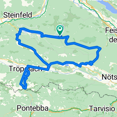
Stockenboi, Weißensee, Kreuzen, Nikelsdorf, Feistritz, Drauradweg, Rennstein, Großvassach, Kleinvassach, Urlaken, Annenheim, Sattendorf
- -:--
- Duration
- 65 km
- Distance
- 461 m
- Ascent
- 752 m
- Descent
- ---
- Avg. speed
- ---
- Max. altitude

Route quality
Waytypes & surfaces along the route
Waytypes
Road
26 km
(40 %)
Cycleway
20.2 km
(31 %)
Surfaces
Paved
41.1 km
(63 %)
Unpaved
11.3 km
(17 %)
Asphalt
37.7 km
(58 %)
Gravel
6.3 km
(10 %)
Continue with Bikemap
Use, edit, or download this cycling route
You would like to ride Stockenboi - Sattendorf or customize it for your own trip? Here is what you can do with this Bikemap route:
Free features
- Save this route as favorite or in collections
- Copy & plan your own version of this route
- Sync your route with Garmin or Wahoo
Premium features
Free trial for 3 days, or one-time payment. More about Bikemap Premium.
- Navigate this route on iOS & Android
- Export a GPX / KML file of this route
- Create your custom printout (try it for free)
- Download this route for offline navigation
Discover more Premium features.
Get Bikemap PremiumFrom our community
Other popular routes starting in Stockenboi
 Goldeck
- Distance
- 71.6 km
- Ascent
- 3,244 m
- Descent
- 3,250 m
- Location
- Stockenboi, Carinthia, Austria
 Stockenboi - Sattendorf 2
- Distance
- 67 km
- Ascent
- 405 m
- Descent
- 696 m
- Location
- Stockenboi, Carinthia, Austria
 Weißensee-Runde
- Distance
- 31.8 km
- Ascent
- 828 m
- Descent
- 828 m
- Location
- Stockenboi, Carinthia, Austria
 RR-Berg: WeissenseeOstufer-Hermagor-Greifenburg-Möllbrücke-Spittal-Zlan-WeissenseeOstufer
- Distance
- 133.8 km
- Ascent
- 1,408 m
- Descent
- 1,408 m
- Location
- Stockenboi, Carinthia, Austria
 Stockenboi - Sattendorf
- Distance
- 65 km
- Ascent
- 461 m
- Descent
- 752 m
- Location
- Stockenboi, Carinthia, Austria
 Käserunde Tressdorfer Alm
- Distance
- 110.2 km
- Ascent
- 1,847 m
- Descent
- 1,869 m
- Location
- Stockenboi, Carinthia, Austria
 Weißensee-Runde
- Distance
- 40.6 km
- Ascent
- 1,153 m
- Descent
- 1,153 m
- Location
- Stockenboi, Carinthia, Austria
 RR-Berg: WeissenseeOstufer-Hermagor-WeissenseeWestufer-Neusach
- Distance
- 66.8 km
- Ascent
- 930 m
- Descent
- 932 m
- Location
- Stockenboi, Carinthia, Austria
Open it in the app