

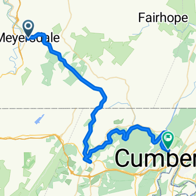
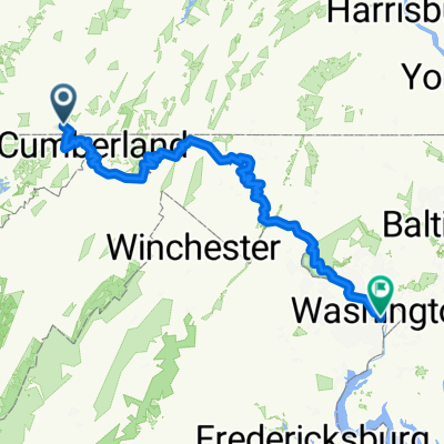
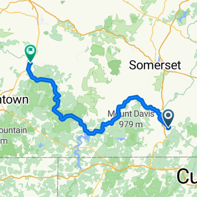
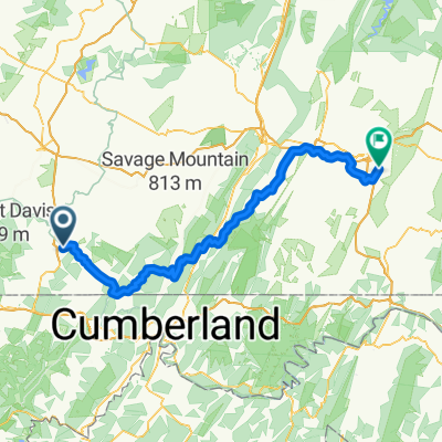
Spring Break Continental Divide to DC
A cycling route starting in Meyersdale, Pennsylvania, United States of America.
Overview
About this route
Small part of GAP trail and entirety of C&O Canal path for 4 States and DC for spring break bikepacking trip.
- -:--
- Duration
- 339.3 km
- Distance
- 73 m
- Ascent
- 783 m
- Descent
- ---
- Avg. speed
- ---
- Max. altitude
Route quality
Waytypes & surfaces along the route
Waytypes
Path
228.9 km
(67 %)
Cycleway
73.8 km
(22 %)
Surfaces
Paved
26.7 km
(8 %)
Unpaved
290.8 km
(86 %)
Ground
211.4 km
(62 %)
Gravel
59.3 km
(17 %)
Continue with Bikemap
Use, edit, or download this cycling route
You would like to ride Spring Break Continental Divide to DC or customize it for your own trip? Here is what you can do with this Bikemap route:
Free features
- Save this route as favorite or in collections
- Copy & plan your own version of this route
- Split it into stages to create a multi-day tour
- Sync your route with Garmin or Wahoo
Premium features
Free trial for 3 days, or one-time payment. More about Bikemap Premium.
- Navigate this route on iOS & Android
- Export a GPX / KML file of this route
- Create your custom printout (try it for free)
- Download this route for offline navigation
Discover more Premium features.
Get Bikemap PremiumFrom our community
Other popular routes starting in Meyersdale
 High Street 414, Meyersdale to Main Street 507, Meyersdale
- Distance
- 37.8 km
- Ascent
- 740 m
- Descent
- 742 m
- Location
- Meyersdale, Pennsylvania, United States of America
 Berlin Street 1787, Garrett to Great Allegheny Passage
- Distance
- 24.6 km
- Ascent
- 390 m
- Descent
- 252 m
- Location
- Meyersdale, Pennsylvania, United States of America
 Restful route in Cumberland
- Distance
- 54.6 km
- Ascent
- 321 m
- Descent
- 733 m
- Location
- Meyersdale, Pennsylvania, United States of America
 GAP Day?
- Distance
- 120.9 km
- Ascent
- 42 m
- Descent
- 488 m
- Location
- Meyersdale, Pennsylvania, United States of America
 Spring Break Continental Divide to DC
- Distance
- 339.3 km
- Ascent
- 73 m
- Descent
- 783 m
- Location
- Meyersdale, Pennsylvania, United States of America
 Center Street to West Crawford Avenue
- Distance
- 92.7 km
- Ascent
- 1,905 m
- Descent
- 2,229 m
- Location
- Meyersdale, Pennsylvania, United States of America
 Meyersdale - Connelsville
- Distance
- 92.1 km
- Ascent
- 66 m
- Descent
- 400 m
- Location
- Meyersdale, Pennsylvania, United States of America
 Center Street to South Valley Road
- Distance
- 114.2 km
- Ascent
- 2,424 m
- Descent
- 2,666 m
- Location
- Meyersdale, Pennsylvania, United States of America
Open it in the app