

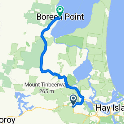
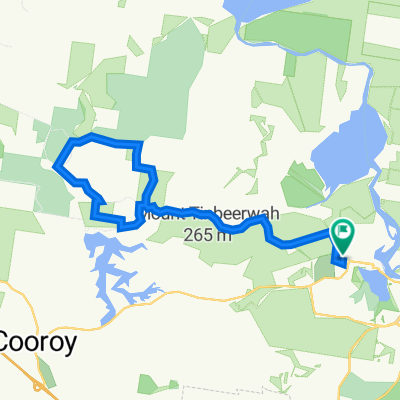
Boreen Point
A cycling route starting in Tewantin, Queensland, Australia.OverviewAbout this route
- -:--
- Duration
- 18.3 km
- Distance
- 0 m
- Ascent
- 0 m
- Descent
- ---
- Avg. speed
- ---
- Max. altitude
John Blakecreated this 6 years ago
Waytypes
Road
17.2 km94 %Pedestrian area
0.5 km3 %
Surfaces
Paved
17.5 km(96 %)Asphalt
17.2 km94 %Paved (undefined)
0.4 km2 %Undefined
0.7 km4 %
Free features
- Save this route as favorite or in collections
- Copy & plan your own version of this route
- Sync your route with Garmin or Wahoo
Premium features
Free trial for 3 days, or one-time payment. More about Bikemap Premium.
- Navigate this route on iOS & Android
- Export a GPX / KML file of this route
- Create your custom printout (try it for free)
- Download this route for offline navigation
Discover more Premium features.
Get Bikemap Premium- Goodchap Street to Ric Glen Road
- 65.9 km
- 826 m
- 750 m
- Tewantin, Queensland, Australia
- Route to Eumundi Markets Coach Parking
- 15.2 km
- 291 m
- 267 m
- Tewantin, Queensland, Australia
- Relaxed route in Bore7en54)^ Point
- 20.5 km
- 125 m
- 126 m
- Tewantin, Queensland, Australia
- Boreen Point 2
- 20.3 km
- 121 m
- 119 m
- Tewantin, Queensland, Australia
- Noosa Enduro 100 (Copy) (Copy) (Copy)
- 32.8 km
- 0 m
- 0 m
- Tewantin, Queensland, Australia
- Poinciana Avenue to Wallace Dr at Noosa Leisure Centre
- 24.5 km
- 116 m
- 158 m
- Tewantin, Queensland, Australia
- Noosa Lake Explora
- 25 km
- 153 m
- 153 m
- Tewantin, Queensland, Australia


Open it in the app