

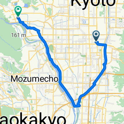
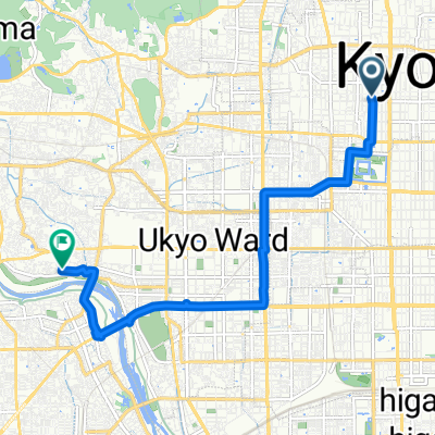
Takao-Nishikyogoku
A cycling route starting in Kyoto, Kyoto, Japan.
Overview
About this route
- -:--
- Duration
- 9.5 km
- Distance
- 239 m
- Ascent
- 95 m
- Descent
- ---
- Avg. speed
- ---
- Max. altitude

Continue with Bikemap
Use, edit, or download this cycling route
You would like to ride Takao-Nishikyogoku or customize it for your own trip? Here is what you can do with this Bikemap route:
Free features
- Save this route as favorite or in collections
- Copy & plan your own version of this route
- Sync your route with Garmin or Wahoo
Premium features
Free trial for 3 days, or one-time payment. More about Bikemap Premium.
- Navigate this route on iOS & Android
- Export a GPX / KML file of this route
- Create your custom printout (try it for free)
- Download this route for offline navigation
Discover more Premium features.
Get Bikemap PremiumFrom our community
Other popular routes starting in Kyoto
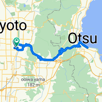 Kyoto to otsu biwa lake to kyoto
- Distance
- 39.4 km
- Ascent
- 852 m
- Descent
- 877 m
- Location
- Kyoto, Kyoto, Japan
 Takatsujicho, Kyoto to Ukyo, Kyoto
- Distance
- 19.5 km
- Ascent
- 105 m
- Descent
- 98 m
- Location
- Kyoto, Kyoto, Japan
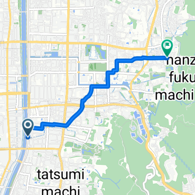
 京都市 まで半木の道
- Distance
- 11.2 km
- Ascent
- 118 m
- Descent
- 113 m
- Location
- Kyoto, Kyoto, Japan
 White Boddha
- Distance
- 21.1 km
- Ascent
- 61 m
- Descent
- 80 m
- Location
- Kyoto, Kyoto, Japan
 Shijo-ohashi Bridge, 교토시에서 사쿄구, 교토시까지
- Distance
- 3.4 km
- Ascent
- 23 m
- Descent
- 0 m
- Location
- Kyoto, Kyoto, Japan
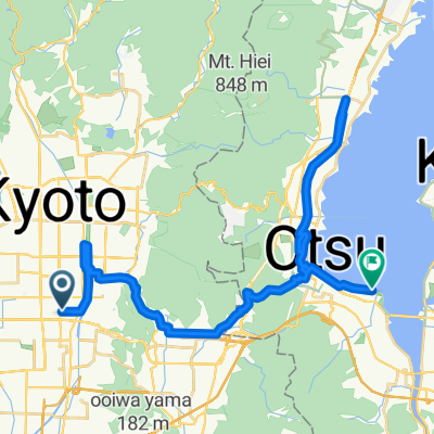 Kyoto to Otsu
- Distance
- 35.5 km
- Ascent
- 353 m
- Descent
- 311 m
- Location
- Kyoto, Kyoto, Japan
 Kioto - Kōbe
- Distance
- 84.6 km
- Ascent
- 306 m
- Descent
- 330 m
- Location
- Kyoto, Kyoto, Japan
 安定した走行
- Distance
- 9.4 km
- Ascent
- 30 m
- Descent
- 92 m
- Location
- Kyoto, Kyoto, Japan
Open it in the app