

Route des Grandes Alpes 2019 - stage 6
A cycling route starting in Barcelonnette, Provence-Alpes-Côte d'Azur Region, France.
Overview
About this route
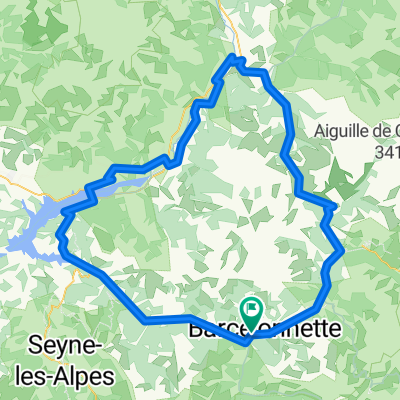
Barcelonnette - via D902 - Bayasse - Col de la Cayolle - Entraunes - Saint Martin d'Entraunes - La Ribiere - Guillaumes - Saint Bres - Valberg - Roubion - Saint Sauveur sur Tinée - La Bolline - Saint Dalmas - Valdeblore
Col de la Cayolle (2326 m)
Col de Valberg (1673 m)
Col de la Couillole (1678 m)
- -:--
- Duration
- 123.8 km
- Distance
- 3,123 m
- Ascent
- 2,952 m
- Descent
- ---
- Avg. speed
- ---
- Max. altitude

Route quality
Waytypes & surfaces along the route
Waytypes
Busy road
121.9 km
(98 %)
Quiet road
1.1 km
(<1 %)
Surfaces
Paved
44.2 km
(36 %)
Asphalt
41.5 km
(33 %)
Paved (undefined)
2.7 km
(2 %)
Undefined
79.6 km
(64 %)
Continue with Bikemap
Use, edit, or download this cycling route
You would like to ride Route des Grandes Alpes 2019 - stage 6 or customize it for your own trip? Here is what you can do with this Bikemap route:
Free features
- Save this route as favorite or in collections
- Copy & plan your own version of this route
- Split it into stages to create a multi-day tour
- Sync your route with Garmin or Wahoo
Premium features
Free trial for 3 days, or one-time payment. More about Bikemap Premium.
- Navigate this route on iOS & Android
- Export a GPX / KML file of this route
- Create your custom printout (try it for free)
- Download this route for offline navigation
Discover more Premium features.
Get Bikemap PremiumFrom our community
Other popular routes starting in Barcelonnette
 Allauch 8. Etappe
- Distance
- 92.5 km
- Ascent
- 1,242 m
- Descent
- 1,623 m
- Location
- Barcelonnette, Provence-Alpes-Côte d'Azur Region, France
 2016 Ride Day 83 - Barcelonnette Circle Col de la Cayolle
- Distance
- 60.9 km
- Ascent
- 1,181 m
- Descent
- 1,184 m
- Location
- Barcelonnette, Provence-Alpes-Côte d'Azur Region, France
 Vars Pontis Jean
- Distance
- 122.3 km
- Ascent
- 1,868 m
- Descent
- 1,873 m
- Location
- Barcelonnette, Provence-Alpes-Côte d'Azur Region, France
 Route in La Condamine-Châtelard
- Distance
- 140.2 km
- Ascent
- 5,301 m
- Descent
- 5,303 m
- Location
- Barcelonnette, Provence-Alpes-Côte d'Azur Region, France
 FR Alpes Circuit des 3 Cols
- Distance
- 116.8 km
- Ascent
- 3,133 m
- Descent
- 3,133 m
- Location
- Barcelonnette, Provence-Alpes-Côte d'Azur Region, France
 3 Cols (Alos, Champs, Cayolle)
- Distance
- 115.2 km
- Ascent
- 3,187 m
- Descent
- 3,188 m
- Location
- Barcelonnette, Provence-Alpes-Côte d'Azur Region, France
 2016 Ride Day 84 - Barcelonnette to Guillestre
- Distance
- 52.3 km
- Ascent
- 1,036 m
- Descent
- 1,124 m
- Location
- Barcelonnette, Provence-Alpes-Côte d'Azur Region, France
 Parque Nacional de Mercantour
- Distance
- 114.8 km
- Ascent
- 3,074 m
- Descent
- 3,074 m
- Location
- Barcelonnette, Provence-Alpes-Côte d'Azur Region, France
Open it in the app