SADO-ICHI (cycle around Sado Island)
A cycling route starting in Ryōtsu-minato, Niigata, Japan.
Overview
About this route
Welcome to Sado Island!
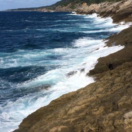
Sado Island is the largest island in Sea of Japan, slightly larger than the size of Singapore! All the roads are paved so you'll enjoy very comfortable ride with the view of the ocean. but the roads are narrow in some part and the traffic might be busy. So please be careful of the traffic and enjoy the spectacular ride!
Stay: There are hotels, ryokan, and hostels. Especially it's easy to find inns in these areas; Ryotsu, Matsugasaki, Akadomari, Ogi, Mano, Sawata, Aikawa.
Camping: There are good camp grounds along the way but most of them are operating only in summer season.
Camp grounds are in; Matsugasaki, Sobama beach, Kubota, Nyuzaki, Futatsugame.
Food: There are supermarkets and restaurants in the larger towns such as Ryotsu,Ogi, Hamochi, Mano, Sawata, Aikawa. But in other small villages along the coast, there are less options and the shops close quite earlier. Please be prepared for it.
- -:--
- Duration
- 208.7 km
- Distance
- 792 m
- Ascent
- 795 m
- Descent
- ---
- Avg. speed
- ---
- Max. altitude
Route quality
Waytypes & surfaces along the route
Waytypes
Quiet road
56.4 km
(27 %)
Road
14.6 km
(7 %)
Surfaces
Paved
2.1 km
(1 %)
Paved (undefined)
2.1 km
(1 %)
Undefined
206.6 km
(99 %)
Route highlights
Points of interest along the route
Point of interest after 1.4 km
Shiisaki Onsen (hot spa) Onsen with stunning view of the lake and mountains. Visit "green hotel Kiraku" and pay for the onsen. (500yen p.p.)
Point of interest after 9 km
Uga Shrine is at the top of a hill. Hundreds of steps to come to the shrine
Point of interest after 17.6 km
Nagisa Park Camping ground
Photo after 35.3 km
Matsugasaki Village Campground, Cafe with handmade donuts, Renovated Japanese traditional holiday home (its name is Kanemo). There are many traditional houses in this small village.
Point of interest after 44.9 km
Onsen (Hot spa)
Point of interest after 46.7 km
Akadomari port Supermarket, convenience store, restaurants, inns, Sake brewery
Point of interest after 59 km
Hamochi town Supermarket, convenience store, restaurant, amazing bakery (its name is T&M)
Point of interest after 62.7 km
Ogi port Supermarket, restaurant, inns
Point of interest after 67.6 km
Shukunegi Village Cafes Shipowners' and shipbuilders' village. traditional houses lined beautifully and you can ride Taraibune, tub boat.
Point of interest after 82.6 km
Sobama beach Camping
Point of interest after 99.4 km
Mano town Supermarket, convenience store, restaurant, inns
Point of interest after 103.5 km
Sawata town Supermarket, convenience store, restaurant, inns
Point of interest after 124.5 km
Aikawa town Supermarket, convenience store, restaurant, inns The town of gold mine, which was found in 16th century. you can visit some historical places and there is a good old alley, Kyomachi street.
Point of interest after 124.7 km
Sado Gold Mine
Photo after 137.2 km
Hiranezaki amazing view of the sea. there are lots of marine potholes
Point of interest after 149.2 km
Nyuzaki beach Camping
Photo after 164.6 km
Z slope steep hill. View is great from the top.
Photo after 173.8 km
Onogame Huge rock and there is a walk path. in early June you can enjoy the picturesque flowers. Lodge, lunch
Photo after 176.4 km
Futatsugame Two huge rocks Restaurant, inn, camping, best beach
Point of interest after 180.5 km
Washisaki village Supermarket
Point of interest after 208.7 km
Ryotsu port Supermarket, convenience store, restaurant, inns
Continue with Bikemap
Use, edit, or download this cycling route
You would like to ride SADO-ICHI (cycle around Sado Island) or customize it for your own trip? Here is what you can do with this Bikemap route:
Free features
- Save this route as favorite or in collections
- Copy & plan your own version of this route
- Split it into stages to create a multi-day tour
- Sync your route with Garmin or Wahoo
Premium features
Free trial for 3 days, or one-time payment. More about Bikemap Premium.
- Navigate this route on iOS & Android
- Export a GPX / KML file of this route
- Create your custom printout (try it for free)
- Download this route for offline navigation
Discover more Premium features.
Get Bikemap PremiumFrom our community
Other popular routes starting in Ryōtsu-minato
 June 6th - Sado Ryotsu Port - Futatsugame
- Distance
- 34.3 km
- Ascent
- 621 m
- Descent
- 543 m
- Location
- Ryōtsu-minato, Niigata, Japan
 佐渡市 to 佐渡市
- Distance
- 203 km
- Ascent
- 7,684 m
- Descent
- 7,678 m
- Location
- Ryōtsu-minato, Niigata, Japan
 1452−1, 佐渡市 まで佐渡市
- Distance
- 9.8 km
- Ascent
- 34 m
- Descent
- 90 m
- Location
- Ryōtsu-minato, Niigata, Japan
 佐渡市 まで佐渡市
- Distance
- 1.9 km
- Ascent
- 9 m
- Descent
- 41 m
- Location
- Ryōtsu-minato, Niigata, Japan
 2013/05/04佐渡上陸
- Distance
- 33.2 km
- Ascent
- 250 m
- Descent
- 242 m
- Location
- Ryōtsu-minato, Niigata, Japan
 sado2
sado2- Distance
- 135.1 km
- Ascent
- 1,305 m
- Descent
- 1,302 m
- Location
- Ryōtsu-minato, Niigata, Japan
 たびのホテル佐渡 から Guest Villa on the 美一 へのルート - たびのホテル佐渡 - Guest Villa on the 美一
- Distance
- 124 km
- Ascent
- 2,802 m
- Descent
- 2,816 m
- Location
- Ryōtsu-minato, Niigata, Japan
 あぜ道里山コース
- Distance
- 22.6 km
- Ascent
- 138 m
- Descent
- 139 m
- Location
- Ryōtsu-minato, Niigata, Japan
Open it in the app


