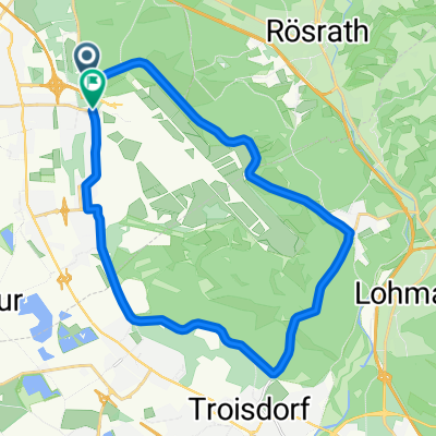
Wahnbachtalsperre ab Wahn (2)
A cycling route starting in Eil, North Rhine-Westphalia, Germany.
Overview
About this route
- -:--
- Duration
- 52.2 km
- Distance
- 463 m
- Ascent
- 462 m
- Descent
- ---
- Avg. speed
- ---
- Avg. speed
Route quality
Waytypes & surfaces along the route
Waytypes
Quiet road
17.8 km
(34 %)
Busy road
12.9 km
(25 %)
Surfaces
Paved
35.5 km
(68 %)
Unpaved
8.4 km
(16 %)
Asphalt
34.5 km
(66 %)
Unpaved (undefined)
3.6 km
(7 %)
Continue with Bikemap
Use, edit, or download this cycling route
You would like to ride Wahnbachtalsperre ab Wahn (2) or customize it for your own trip? Here is what you can do with this Bikemap route:
Free features
- Save this route as favorite or in collections
- Copy & plan your own version of this route
- Sync your route with Garmin or Wahoo
Premium features
Free trial for 3 days, or one-time payment. More about Bikemap Premium.
- Navigate this route on iOS & Android
- Export a GPX / KML file of this route
- Create your custom printout (try it for free)
- Download this route for offline navigation
Discover more Premium features.
Get Bikemap PremiumFrom our community
Other popular routes starting in Eil
- MTB-Training vom 24.01.2010
- Distance
- 36 km
- Ascent
- 331 m
- Descent
- 330 m
- Location
- Eil, North Rhine-Westphalia, Germany
- Bergische Trainingsrunde
- Distance
- 82.1 km
- Ascent
- 897 m
- Descent
- 878 m
- Location
- Eil, North Rhine-Westphalia, Germany
- 2021 03 Porz - Eschmarer Mühle - Hangelar und übers Antonium zurück
- Distance
- 54.8 km
- Ascent
- 309 m
- Descent
- 304 m
- Location
- Eil, North Rhine-Westphalia, Germany
- MTB 5.12.2009
- Distance
- 35.9 km
- Ascent
- 373 m
- Descent
- 369 m
- Location
- Eil, North Rhine-Westphalia, Germany
- MTB Königsforst vom 22.11.2009
- Distance
- 33.9 km
- Ascent
- 283 m
- Descent
- 285 m
- Location
- Eil, North Rhine-Westphalia, Germany
- 2021 04 Porz - Königsforst - Hasbach - Lohmar - Inger-Birk - Wahnbachtalsperre und an der Sieg zurück
- Distance
- 73.7 km
- Ascent
- 818 m
- Descent
- 827 m
- Location
- Eil, North Rhine-Westphalia, Germany
- Eil - Troisdorf - Altenrath - (Flughafen) - Eil
- Distance
- 32.5 km
- Ascent
- 127 m
- Descent
- 118 m
- Location
- Eil, North Rhine-Westphalia, Germany
- Porz Eil Wahner Heide - Wahnbachtalsperre
- Distance
- 20.9 km
- Ascent
- 242 m
- Descent
- 158 m
- Location
- Eil, North Rhine-Westphalia, Germany
Open it in the app