

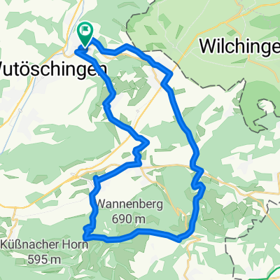
Côte Krenkingen, 656m
A cycling route starting in Wutöschingen, Baden-Wurttemberg, Germany.
Overview
About this route
4.1 km, with some steep ramps
- -:--
- Duration
- 4.1 km
- Distance
- 257 m
- Ascent
- 0 m
- Descent
- ---
- Avg. speed
- ---
- Max. altitude

Route quality
Waytypes & surfaces along the route
Waytypes
Road
2.3 km
(57 %)
Quiet road
1.8 km
(43 %)
Continue with Bikemap
Use, edit, or download this cycling route
You would like to ride Côte Krenkingen, 656m or customize it for your own trip? Here is what you can do with this Bikemap route:
Free features
- Save this route as favorite or in collections
- Copy & plan your own version of this route
- Sync your route with Garmin or Wahoo
Premium features
Free trial for 3 days, or one-time payment. More about Bikemap Premium.
- Navigate this route on iOS & Android
- Export a GPX / KML file of this route
- Create your custom printout (try it for free)
- Download this route for offline navigation
Discover more Premium features.
Get Bikemap PremiumFrom our community
Other popular routes starting in Wutöschingen
 Wutöschingen-Bergöschingen-Küssaburg
- Distance
- 28.8 km
- Ascent
- 615 m
- Descent
- 615 m
- Location
- Wutöschingen, Baden-Wurttemberg, Germany
 Degernau - Wannenberg
- Distance
- 27.7 km
- Ascent
- 700 m
- Descent
- 700 m
- Location
- Wutöschingen, Baden-Wurttemberg, Germany
 Über die Höhen des Wutachtals
- Distance
- 33.4 km
- Ascent
- 409 m
- Descent
- 411 m
- Location
- Wutöschingen, Baden-Wurttemberg, Germany
 Klettgau, Zürcher Weinland
- Distance
- 98.8 km
- Ascent
- 410 m
- Descent
- 411 m
- Location
- Wutöschingen, Baden-Wurttemberg, Germany
 Degernau - Faudiwegtrail
- Distance
- 35.6 km
- Ascent
- 637 m
- Descent
- 637 m
- Location
- Wutöschingen, Baden-Wurttemberg, Germany
 Côte Krenkingen, 656m
- Distance
- 4.1 km
- Ascent
- 257 m
- Descent
- 0 m
- Location
- Wutöschingen, Baden-Wurttemberg, Germany
 Klettgau, Furka
- Distance
- 177.5 km
- Ascent
- 1,820 m
- Descent
- 676 m
- Location
- Wutöschingen, Baden-Wurttemberg, Germany
 Tour 5
- Distance
- 16.6 km
- Ascent
- 313 m
- Descent
- 313 m
- Location
- Wutöschingen, Baden-Wurttemberg, Germany
Open it in the app