
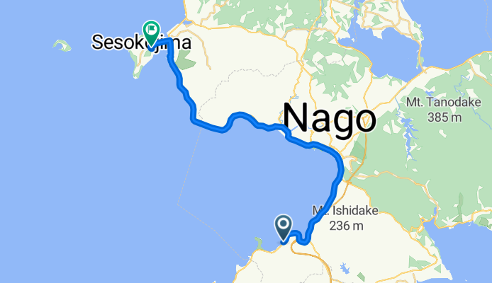
23/12 那霸 》瀨底島
A cycling route starting in Nago, Okinawa, Japan.
Overview
About this route
- 2 h 34 min
- Duration
- 25.8 km
- Distance
- 103 m
- Ascent
- 64 m
- Descent
- 10 km/h
- Avg. speed
- ---
- Max. altitude

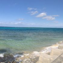
Route photos


Continue with Bikemap
Use, edit, or download this cycling route
You would like to ride 23/12 那霸 》瀨底島 or customize it for your own trip? Here is what you can do with this Bikemap route:
Free features
- Save this route as favorite or in collections
- Copy & plan your own version of this route
- Sync your route with Garmin or Wahoo
Premium features
Free trial for 3 days, or one-time payment. More about Bikemap Premium.
- Navigate this route on iOS & Android
- Export a GPX / KML file of this route
- Create your custom printout (try it for free)
- Download this route for offline navigation
Discover more Premium features.
Get Bikemap PremiumFrom our community
Other popular routes starting in Nago
 2015.078.01 Okinawa Day2
- Distance
- 81.1 km
- Ascent
- 303 m
- Descent
- 305 m
- Location
- Nago, Okinawa, Japan
 23/12 那霸 》瀨底島
- Distance
- 25.8 km
- Ascent
- 103 m
- Descent
- 64 m
- Location
- Nago, Okinawa, Japan
 Tour de Okinawa 2017 (100km)
- Distance
- 96.3 km
- Ascent
- 667 m
- Descent
- 670 m
- Location
- Nago, Okinawa, Japan
 Okinawa Bike Day2
- Distance
- 71.5 km
- Ascent
- 430 m
- Descent
- 436 m
- Location
- Nago, Okinawa, Japan
 2012環沖繩自行車大賽323KM挑戰賽
- Distance
- 343.3 km
- Ascent
- 854 m
- Descent
- 853 m
- Location
- Nago, Okinawa, Japan
 2019.11.22-24 極星車隊 北Okinawa 騎旅
- Distance
- 216.6 km
- Ascent
- 1,361 m
- Descent
- 1,356 m
- Location
- Nago, Okinawa, Japan
 沖繩環島 Day 4 Adjusted
- Distance
- 58.4 km
- Ascent
- 780 m
- Descent
- 846 m
- Location
- Nago, Okinawa, Japan
 沖繩環島 Day 5
- Distance
- 63.3 km
- Ascent
- 1,007 m
- Descent
- 968 m
- Location
- Nago, Okinawa, Japan
Open it in the app