

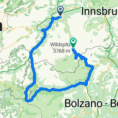
Innradweg-Reutte-Passau_2
A cycling route starting in Roppen, Tyrol, Austria.
Overview
About this route
- -:--
- Duration
- 365.3 km
- Distance
- 110 m
- Ascent
- 525 m
- Descent
- ---
- Avg. speed
- ---
- Max. altitude

Route quality
Waytypes & surfaces along the route
Waytypes
Track
157.1 km
(43 %)
Quiet road
109.6 km
(30 %)
Surfaces
Paved
244.8 km
(67 %)
Unpaved
105.9 km
(29 %)
Asphalt
244.8 km
(67 %)
Gravel
65.8 km
(18 %)
Continue with Bikemap
Use, edit, or download this cycling route
You would like to ride Innradweg-Reutte-Passau_2 or customize it for your own trip? Here is what you can do with this Bikemap route:
Free features
- Save this route as favorite or in collections
- Copy & plan your own version of this route
- Split it into stages to create a multi-day tour
- Sync your route with Garmin or Wahoo
Premium features
Free trial for 3 days, or one-time payment. More about Bikemap Premium.
- Navigate this route on iOS & Android
- Export a GPX / KML file of this route
- Create your custom printout (try it for free)
- Download this route for offline navigation
Discover more Premium features.
Get Bikemap PremiumFrom our community
Other popular routes starting in Roppen
 Alpen15-2
- Distance
- 101 km
- Ascent
- 1,593 m
- Descent
- 1,404 m
- Location
- Roppen, Tyrol, Austria
 Kronburg von Roppen
- Distance
- 18.1 km
- Ascent
- 448 m
- Descent
- 241 m
- Location
- Roppen, Tyrol, Austria
 Löckpuit 4, Roppen nach Siedlungsstraße 6, Haiming
- Distance
- 8.3 km
- Ascent
- 190 m
- Descent
- 250 m
- Location
- Roppen, Tyrol, Austria
 Industriegebiet 1106/1 to Straße ohne Straßennamen, Gaschurn
- Distance
- 82.5 km
- Ascent
- 3,498 m
- Descent
- 2,370 m
- Location
- Roppen, Tyrol, Austria
 Stilfzer Joch Rundkurs
- Distance
- 274.4 km
- Ascent
- 5,323 m
- Descent
- 4,705 m
- Location
- Roppen, Tyrol, Austria
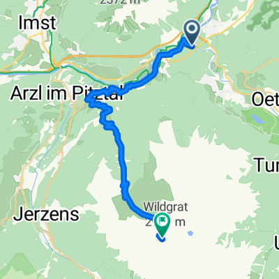 Von Roppen bis Sankt Leonhard im Pitztal
- Distance
- 21.1 km
- Ascent
- 2,436 m
- Descent
- 242 m
- Location
- Roppen, Tyrol, Austria
 Trankhütte, Roppen nach Rathausstraße 9, Imst
- Distance
- 9.7 km
- Ascent
- 251 m
- Descent
- 198 m
- Location
- Roppen, Tyrol, Austria
 Industriegebiet 1106/1 to Straße ohne Straßennamen, Gaschurn
- Distance
- 73.8 km
- Ascent
- 2,576 m
- Descent
- 1,448 m
- Location
- Roppen, Tyrol, Austria
Open it in the app