

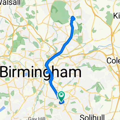
Route to Work
A cycling route starting in Acocks Green, England, United Kingdom.
Overview
About this route
- 1 h 1 min
- Duration
- 6.7 km
- Distance
- 76 m
- Ascent
- 46 m
- Descent
- 6.6 km/h
- Avg. speed
- ---
- Max. altitude

Continue with Bikemap
Use, edit, or download this cycling route
You would like to ride Route to Work or customize it for your own trip? Here is what you can do with this Bikemap route:
Free features
- Save this route as favorite or in collections
- Copy & plan your own version of this route
- Sync your route with Garmin or Wahoo
Premium features
Free trial for 3 days, or one-time payment. More about Bikemap Premium.
- Navigate this route on iOS & Android
- Export a GPX / KML file of this route
- Create your custom printout (try it for free)
- Download this route for offline navigation
Discover more Premium features.
Get Bikemap PremiumFrom our community
Other popular routes starting in Acocks Green
 Birmingham to Tetbury
- Distance
- 115.6 km
- Ascent
- 420 m
- Descent
- 428 m
- Location
- Acocks Green, England, United Kingdom
 Birmingham to Marple
- Distance
- 136.9 km
- Ascent
- 656 m
- Descent
- 634 m
- Location
- Acocks Green, England, United Kingdom
 Wagon Lane 124 to Wagon Lane 121
- Distance
- 35.7 km
- Ascent
- 263 m
- Descent
- 258 m
- Location
- Acocks Green, England, United Kingdom
 Solihull
- Distance
- 10.1 km
- Ascent
- 58 m
- Descent
- 55 m
- Location
- Acocks Green, England, United Kingdom
 The Riddings 91 to The Riddings 91
- Distance
- 7.5 km
- Ascent
- 64 m
- Descent
- 117 m
- Location
- Acocks Green, England, United Kingdom
 Moderate route
- Distance
- 19 km
- Ascent
- 111 m
- Descent
- 157 m
- Location
- Acocks Green, England, United Kingdom
 Birmingham to Sutton Coldfield
- Distance
- 36.3 km
- Ascent
- 180 m
- Descent
- 174 m
- Location
- Acocks Green, England, United Kingdom
 Birmingham to Betws-y-Coed
- Distance
- 183.6 km
- Ascent
- 739 m
- Descent
- 832 m
- Location
- Acocks Green, England, United Kingdom
Open it in the app