

HCM tea to Huong Khe
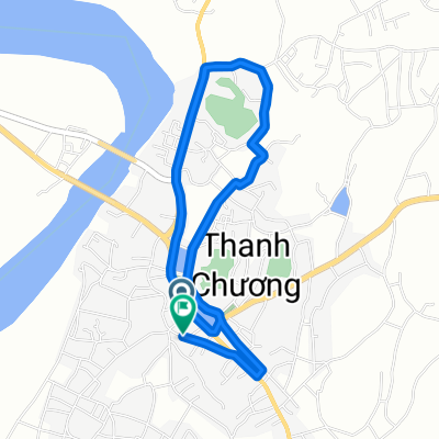
A cycling route starting in Thanh Chương, Nghệ An Province, Vietnam.
Overview
About this route
- -:--
- Duration
- 86.8 km
- Distance
- 337 m
- Ascent
- 349 m
- Descent
- ---
- Avg. speed
- ---
- Max. altitude
Continue with Bikemap
Use, edit, or download this cycling route
You would like to ride HCM tea to Huong Khe or customize it for your own trip? Here is what you can do with this Bikemap route:
Free features
- Save this route as favorite or in collections
- Copy & plan your own version of this route
- Split it into stages to create a multi-day tour
- Sync your route with Garmin or Wahoo
Premium features
Free trial for 3 days, or one-time payment. More about Bikemap Premium.
- Navigate this route on iOS & Android
- Export a GPX / KML file of this route
- Create your custom printout (try it for free)
- Download this route for offline navigation
Discover more Premium features.
Get Bikemap PremiumFrom our community
Other popular routes starting in Thanh Chương
 Quốc lộ 15 to xóm 3
- Distance
- 13.6 km
- Ascent
- 228 m
- Descent
- 226 m
- Location
- Thanh Chương, Nghệ An Province, Vietnam
 HCM tea to Huong Khe
- Distance
- 86.8 km
- Ascent
- 337 m
- Descent
- 349 m
- Location
- Thanh Chương, Nghệ An Province, Vietnam
 phú hậu xã đại đồng tỉnh nghệ an
- Distance
- 9 km
- Ascent
- 23 m
- Descent
- 26 m
- Location
- Thanh Chương, Nghệ An Province, Vietnam
 Thanh An - Huong Khe 12/30
- Distance
- 90.2 km
- Ascent
- 243 m
- Descent
- 248 m
- Location
- Thanh Chương, Nghệ An Province, Vietnam
 Quốc Lộ 15, H. Đô Lương to Quốc Lộ 15, H. Đô Lương
- Distance
- 14.9 km
- Ascent
- 196 m
- Descent
- 195 m
- Location
- Thanh Chương, Nghệ An Province, Vietnam
Open it in the app