

John Muir Way Part 2
A cycling route starting in Lennoxtown, Scotland, United Kingdom.
Overview
About this route
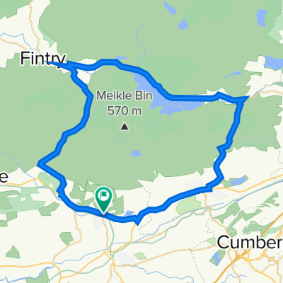
Lennoxtown to Bo'mains Farm B&B
- -:--
- Duration
- 49.9 km
- Distance
- 200 m
- Ascent
- 148 m
- Descent
- ---
- Avg. speed
- ---
- Max. altitude

Route quality
Waytypes & surfaces along the route
Waytypes
Cycleway
38.9 km
(78 %)
Road
2.5 km
(5 %)
Surfaces
Paved
34 km
(68 %)
Unpaved
1 km
(2 %)
Asphalt
31.5 km
(63 %)
Paved (undefined)
2.5 km
(5 %)
Continue with Bikemap
Use, edit, or download this cycling route
You would like to ride John Muir Way Part 2 or customize it for your own trip? Here is what you can do with this Bikemap route:
Free features
- Save this route as favorite or in collections
- Copy & plan your own version of this route
- Sync your route with Garmin or Wahoo
Premium features
Free trial for 3 days, or one-time payment. More about Bikemap Premium.
- Navigate this route on iOS & Android
- Export a GPX / KML file of this route
- Create your custom printout (try it for free)
- Download this route for offline navigation
Discover more Premium features.
Get Bikemap PremiumFrom our community
Other popular routes starting in Lennoxtown
 Crow road and Tak Ma Doon circular
- Distance
- 42.5 km
- Ascent
- 597 m
- Descent
- 594 m
- Location
- Lennoxtown, Scotland, United Kingdom
 Rose Commute
- Distance
- 26.9 km
- Ascent
- 22 m
- Descent
- 75 m
- Location
- Lennoxtown, Scotland, United Kingdom
 Family Celtic Route
- Distance
- 5.2 km
- Ascent
- 69 m
- Descent
- 69 m
- Location
- Lennoxtown, Scotland, United Kingdom
 Campsie Fells and Lennox Forest
- Distance
- 18.6 km
- Ascent
- 604 m
- Descent
- 612 m
- Location
- Lennoxtown, Scotland, United Kingdom
 Ferguson Park to Top of Campsies
- Distance
- 7 km
- Ascent
- 10 m
- Descent
- 404 m
- Location
- Lennoxtown, Scotland, United Kingdom
 Lake of Menteith loop (7)
- Distance
- 6.3 km
- Ascent
- 238 m
- Descent
- 11 m
- Location
- Lennoxtown, Scotland, United Kingdom
 Main Street 216, Lennoxtown to Crow Road
- Distance
- 3.7 km
- Ascent
- 146 m
- Descent
- 1 m
- Location
- Lennoxtown, Scotland, United Kingdom
 Lennox Forest, Balmore Quarry and Trig Point
- Distance
- 11.8 km
- Ascent
- 222 m
- Descent
- 221 m
- Location
- Lennoxtown, Scotland, United Kingdom
Open it in the app