Trissington circle
A cycling route starting in Ashbourne, England, United Kingdom.
Overview
About this route
- -:--
- Duration
- 28 km
- Distance
- 311 m
- Ascent
- 305 m
- Descent
- ---
- Avg. speed
- ---
- Avg. speed
Route quality
Waytypes & surfaces along the route
Waytypes
Undefined
28 km
(100 %)
Surfaces
Undefined
28 km
(100 %)
Continue with Bikemap
Use, edit, or download this cycling route
You would like to ride Trissington circle or customize it for your own trip? Here is what you can do with this Bikemap route:
Free features
- Save this route as favorite or in collections
- Copy & plan your own version of this route
- Sync your route with Garmin or Wahoo
Premium features
Free trial for 3 days, or one-time payment. More about Bikemap Premium.
- Navigate this route on iOS & Android
- Export a GPX / KML file of this route
- Create your custom printout (try it for free)
- Download this route for offline navigation
Discover more Premium features.
Get Bikemap PremiumFrom our community
Other popular routes starting in Ashbourne
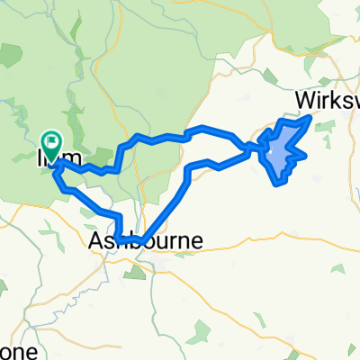
- Ashbourne - Alstonefield loop
- Distance
- 26.1 km
- Ascent
- 486 m
- Descent
- 485 m
- Location
- Ashbourne, England, United Kingdom
- Tissington Trail
- Distance
- 39.8 km
- Ascent
- 518 m
- Descent
- 486 m
- Location
- Ashbourne, England, United Kingdom
- ride in the peak district
- Distance
- 50.1 km
- Ascent
- 723 m
- Descent
- 723 m
- Location
- Ashbourne, England, United Kingdom
- tissington trail to high peak trail
- Distance
- 12.9 km
- Ascent
- 219 m
- Descent
- 159 m
- Location
- Ashbourne, England, United Kingdom
- C38.5 WPC
- Distance
- 62.3 km
- Ascent
- 355 m
- Descent
- 357 m
- Location
- Ashbourne, England, United Kingdom
- Thorpe - Youlgreave - Darley Bridge - Matlock - Riber - Cromford - Wirksworth - Kirk Ireton - Carsington Water - Tissington - Thorpe
- Distance
- 69 km
- Ascent
- 867 m
- Descent
- 868 m
- Location
- Ashbourne, England, United Kingdom
- 09.2018 Cov-M'cr-Cov. Dzien 2/3
- Distance
- 59.4 km
- Ascent
- 491 m
- Descent
- 783 m
- Location
- Ashbourne, England, United Kingdom
- Flashy Manifold Trail
- Distance
- 77.5 km
- Ascent
- 1,186 m
- Descent
- 1,187 m
- Location
- Ashbourne, England, United Kingdom