

Lugares pintorescos
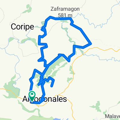
A cycling route starting in Algodonales, Andalusia, Spain.
Overview
About this route
Route
- -:--
- Duration
- 473 km
- Distance
- 798 m
- Ascent
- 1,171 m
- Descent
- ---
- Avg. speed
- ---
- Max. altitude

Route quality
Waytypes & surfaces along the route
Waytypes
Road
189.2 km
(40 %)
Track
89.9 km
(19 %)
Surfaces
Paved
184.5 km
(39 %)
Unpaved
66.2 km
(14 %)
Asphalt
179.7 km
(38 %)
Gravel
33.1 km
(7 %)
Route highlights
Points of interest along the route
Point of interest after 0.1 km
Pueblo pintoresco
Point of interest after 0.3 km
Pueblo pintoresco
Point of interest after 17.1 km
Cascada Riopar
Point of interest after 17.1 km
Cascada
Point of interest after 17.1 km
Cascada Maro. Solo visible desde el mar
Point of interest after 17.1 km
VIA VERDE PAISAJE OXIGENANTE
Point of interest after 17.1 km
Playa Parque Natural de los Acantilados de Maro-Cerro Gordo
Point of interest after 17.1 km
Geoda de Pulpí
Point of interest after 18.1 km
Belmonte
Point of interest after 18.1 km
Paisaje oxigenante
Point of interest after 18.1 km
Cascada
Point of interest after 18.1 km
Cascada de Rupit
Point of interest after 54.3 km
VIA VERDE
Point of interest after 211.5 km
Gruta de las maravillas
Point of interest after 215 km
Almonaster la Real
Point of interest after 215 km
Paisaje oxigenante
Point of interest after 473 km
Punto inicio
Continue with Bikemap
Use, edit, or download this cycling route
You would like to ride Lugares pintorescos or customize it for your own trip? Here is what you can do with this Bikemap route:
Free features
- Save this route as favorite or in collections
- Copy & plan your own version of this route
- Split it into stages to create a multi-day tour
- Sync your route with Garmin or Wahoo
Premium features
Free trial for 3 days, or one-time payment. More about Bikemap Premium.
- Navigate this route on iOS & Android
- Export a GPX / KML file of this route
- Create your custom printout (try it for free)
- Download this route for offline navigation
Discover more Premium features.
Get Bikemap PremiumFrom our community
Other popular routes starting in Algodonales
 Algodonales-El Gastor-Setenil-Torre Alhaquime-Olvera-El Gastor-Algodonales
- Distance
- 63.6 km
- Ascent
- 1,115 m
- Descent
- 1,096 m
- Location
- Algodonales, Andalusia, Spain
 Algodonales-Zahara-Las Palomas-Boyar-Grazalema
- Distance
- 56.8 km
- Ascent
- 1,187 m
- Descent
- 1,187 m
- Location
- Algodonales, Andalusia, Spain
 Algodonales to Grazalema avoiding pass
- Distance
- 29.2 km
- Ascent
- 853 m
- Descent
- 382 m
- Location
- Algodonales, Andalusia, Spain
 Lugares pintorescos
- Distance
- 473 km
- Ascent
- 798 m
- Descent
- 1,171 m
- Location
- Algodonales, Andalusia, Spain
 Algodonales-Zahara-Sierra Margarita ZONA-ESTE BTT 14-11-10
- Distance
- 48.3 km
- Ascent
- 1,093 m
- Descent
- 1,102 m
- Location
- Algodonales, Andalusia, Spain
 mogote semiextrem feb 2011
- Distance
- 31.9 km
- Ascent
- 989 m
- Descent
- 989 m
- Location
- Algodonales, Andalusia, Spain
 Algodonales-Vía Verde-La Muela-Mogote ZONA-ESTE BTT
- Distance
- 60.1 km
- Ascent
- 1,429 m
- Descent
- 1,429 m
- Location
- Algodonales, Andalusia, Spain
 Algodonales-las palomas-
- Distance
- 55.2 km
- Ascent
- 1,621 m
- Descent
- 1,550 m
- Location
- Algodonales, Andalusia, Spain
Open it in the app