St Wilfrid's Way-Route from Hexham to Edinburgh
A cycling route starting in Selkirk, Scotland, United Kingdom.
Overview
About this route
- -:--
- Duration
- 75.9 km
- Distance
- 826 m
- Ascent
- 905 m
- Descent
- ---
- Avg. speed
- ---
- Avg. speed
Route quality
Waytypes & surfaces along the route
Waytypes
Undefined
75.9 km
(100 %)
Surfaces
Undefined
75.9 km
(100 %)
Route highlights
Points of interest along the route
Point of interest after 0.2 km
Border Abbeys Way
Point of interest after 0.2 km
Hadrian's Wall Path
Point of interest after 0.2 km
Dere Street Roman Road
Point of interest after 0.2 km
Joins Pennine Way
Point of interest after 3.4 km
Old Drove Road going west
Point of interest after 21 km
Joins Bike Path to Peebles
Point of interest after 47.6 km
Joins dismantled railway going north
Point of interest after 54.6 km
Joins Bike Track going north
Point of interest after 59.5 km
Rosslyn Chapel
Continue with Bikemap
Use, edit, or download this cycling route
You would like to ride St Wilfrid's Way-Route from Hexham to Edinburgh or customize it for your own trip? Here is what you can do with this Bikemap route:
Free features
- Save this route as favorite or in collections
- Copy & plan your own version of this route
- Sync your route with Garmin or Wahoo
Premium features
Free trial for 3 days, or one-time payment. More about Bikemap Premium.
- Navigate this route on iOS & Android
- Export a GPX / KML file of this route
- Create your custom printout (try it for free)
- Download this route for offline navigation
Discover more Premium features.
Get Bikemap PremiumFrom our community
Other popular routes starting in Selkirk
- Selkirk-Ettrickbridge-Yarrow-Selkirk
- Distance
- 55.1 km
- Ascent
- 356 m
- Descent
- 358 m
- Location
- Selkirk, Scotland, United Kingdom
- The Haining Dairy Cottage, Selkirk to 41/1 High St, Hawick
- Distance
- 31.8 km
- Ascent
- 364 m
- Descent
- 445 m
- Location
- Selkirk, Scotland, United Kingdom
- MTB Selkirk-Innerleiten
- Distance
- 61.6 km
- Ascent
- 1,394 m
- Descent
- 1,397 m
- Location
- Selkirk, Scotland, United Kingdom
- Route from Woodburn Cottage, Heatherlie Park, Selkirk
- Distance
- 24.2 km
- Ascent
- 252 m
- Descent
- 256 m
- Location
- Selkirk, Scotland, United Kingdom
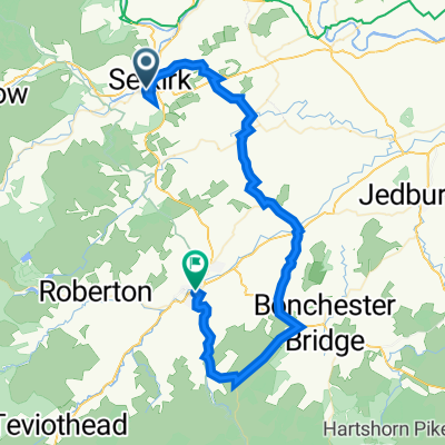
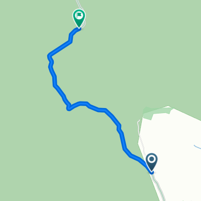
- Greenhill Farm to Greenhill Farm
- Distance
- 3 km
- Ascent
- 207 m
- Descent
- 206 m
- Location
- Selkirk, Scotland, United Kingdom
- Relaxed rouaskirk bowhill selkirk ckerkte in
- Distance
- 27.8 km
- Ascent
- 552 m
- Descent
- 570 m
- Location
- Selkirk, Scotland, United Kingdom
- Waterwheel cafe (Selkirk) - Ettrickbridge - Ettrick - Yarrow
- Distance
- 50.2 km
- Ascent
- 333 m
- Descent
- 334 m
- Location
- Selkirk, Scotland, United Kingdom
- MTB Selkirk-Innerleiten
- Distance
- 61.6 km
- Ascent
- 1,390 m
- Descent
- 1,393 m
- Location
- Selkirk, Scotland, United Kingdom