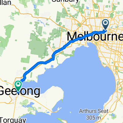
Relaxed route in Fairfield
A cycling route starting in Ivanhoe East, Victoria, Australia.
Overview
About this route
- 1 h 39 min
- Duration
- 14.9 km
- Distance
- 327 m
- Ascent
- 297 m
- Descent
- 9 km/h
- Avg. speed
- ---
- Max. altitude
Route quality
Waytypes & surfaces along the route
Waytypes
Cycleway
7 km
(47 %)
Path
4.3 km
(29 %)
Surfaces
Paved
5.1 km
(34 %)
Unpaved
9.1 km
(61 %)
Unpaved (undefined)
7 km
(47 %)
Asphalt
2.2 km
(15 %)
Continue with Bikemap
Use, edit, or download this cycling route
You would like to ride Relaxed route in Fairfield or customize it for your own trip? Here is what you can do with this Bikemap route:
Free features
- Save this route as favorite or in collections
- Copy & plan your own version of this route
- Sync your route with Garmin or Wahoo
Premium features
Free trial for 3 days, or one-time payment. More about Bikemap Premium.
- Navigate this route on iOS & Android
- Export a GPX / KML file of this route
- Create your custom printout (try it for free)
- Download this route for offline navigation
Discover more Premium features.
Get Bikemap PremiumFrom our community
Other popular routes starting in Ivanhoe East
Blistering ride in Southbank- Distance
- 19.6 km
- Ascent
- 160 m
- Descent
- 175 m
- Location
- Ivanhoe East, Victoria, Australia
Koonung Creek(EastLink) - Mullum Mullum Creek - Yarra River- Diamond Creek - Western/Metropolitan Ring Road - Darebin Creek - Yarra River.- Distance
- 68.8 km
- Ascent
- 505 m
- Descent
- 504 m
- Location
- Ivanhoe East, Victoria, Australia
Work Ride- Distance
- 15.4 km
- Ascent
- 156 m
- Descent
- 169 m
- Location
- Ivanhoe East, Victoria, Australia
Merri Creek - Western/Metropolitan Ring road - Plenty Creek - Yarra River - Anniversary Trail - Ferndale Trail - Gardiners Creek - Yarra River.- Distance
- 74.3 km
- Ascent
- 472 m
- Descent
- 472 m
- Location
- Ivanhoe East, Victoria, Australia
Off Grid Long V2- Distance
- 103.7 km
- Ascent
- 1,854 m
- Descent
- 1,828 m
- Location
- Ivanhoe East, Victoria, Australia
Brief bike tour through Ivanhoe East- Distance
- 4.8 km
- Ascent
- 53 m
- Descent
- 53 m
- Location
- Ivanhoe East, Victoria, Australia
Eastlink North InB- Distance
- 34.9 km
- Ascent
- 203 m
- Descent
- 167 m
- Location
- Ivanhoe East, Victoria, Australia
Capital City Trail from home- Distance
- 31.5 km
- Ascent
- 14 m
- Descent
- 0 m
- Location
- Ivanhoe East, Victoria, Australia
Open it in the app

