
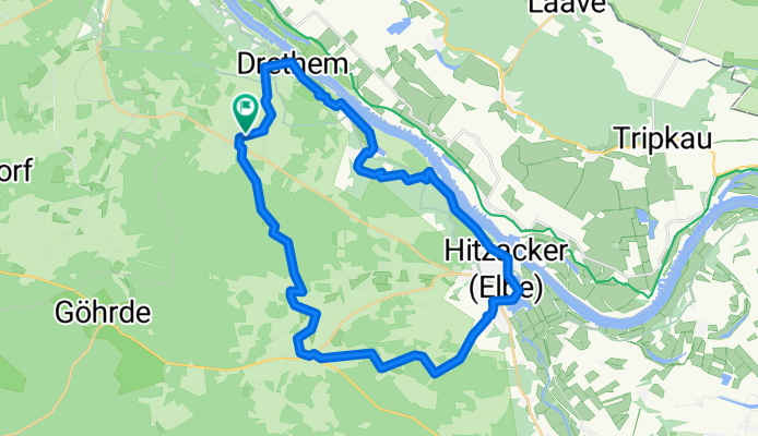


Nieperfitz - Gartow
- 62.8 km
- 198 m
- 230 m
- Göhrde, Lower Saxony, Germany
A cycling route starting in Göhrde, Lower Saxony, Germany.
Overview
The highlight of the route is riding directly along the Elbe river; it is impassable during high water and wet with mosquitoes during moderate high water. The Kniepenberg currently has no tower anymore, here pushing the bike is required. From Tießau onwards, the trail is constantly up and down, overgrown like a primeval forest. The Göhrde forest is very soft. Behind Tollendorf, the very beautiful forest lily trail is signposted.
created this 15 years ago
Route quality
Track
14.2 km
(46 %)
Quiet road
10.2 km
(33 %)
Paved
9.3 km
(30 %)
Unpaved
17 km
(55 %)
Ground
13.9 km
(45 %)
Asphalt
5.9 km
(19 %)
Route highlights
Wer Radfahren will, hier geradeaus weiter, nach oben ist schieben angesagt
Der Aussichtsturm ist weg? Stand 20. 6. 2010.
Treppen!
Hochwasserwiese ... riecht nach Fisch ... Lenkerhohes Gras
Rundlingsdorf Sagasfeld
Waldlilienweg
Continue with Bikemap
You would like to ride Hitzackerrunde or customize it for your own trip? Here is what you can do with this Bikemap route:
Free trial for 3 days, or one-time payment. More about Bikemap Premium.
Discover more Premium features.
Get Bikemap PremiumFrom our community
Open it in the app


