

home to sams
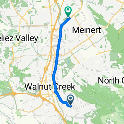
A cycling route starting in Walnut Creek, California, United States.
Overview
About this route
- 48 min
- Duration
- 8.7 km
- Distance
- 53 m
- Ascent
- 108 m
- Descent
- 10.9 km/h
- Avg. speed
- ---
- Max. altitude

Continue with Bikemap
Use, edit, or download this cycling route
You would like to ride home to sams or customize it for your own trip? Here is what you can do with this Bikemap route:
Free features
- Save this route as favorite or in collections
- Copy & plan your own version of this route
- Sync your route with Garmin or Wahoo
Premium features
Free trial for 3 days, or one-time payment. More about Bikemap Premium.
- Navigate this route on iOS & Android
- Export a GPX / KML file of this route
- Create your custom printout (try it for free)
- Download this route for offline navigation
Discover more Premium features.
Get Bikemap PremiumFrom our community
Other popular routes starting in Walnut Creek
 Epidemic Ales 🍺 Loop
- Distance
- 31.2 km
- Ascent
- 100 m
- Descent
- 89 m
- Location
- Walnut Creek, California, United States
 Diablo to Tilden Loop
- Distance
- 114.1 km
- Ascent
- 1,434 m
- Descent
- 1,434 m
- Location
- Walnut Creek, California, United States
 2295 N Main St, Walnut Creek to 1259 Broadway Plz, Walnut Creek
- Distance
- 2.9 km
- Ascent
- 16 m
- Descent
- 13 m
- Location
- Walnut Creek, California, United States
 De Ygnacio Valley Road 297, Walnut Creek a Adelaide Street 1731, Concord
- Distance
- 10.9 km
- Ascent
- 27 m
- Descent
- 70 m
- Location
- Walnut Creek, California, United States
 80 Norlyn Dr, Walnut Creek to 300 N Civic Dr, Walnut Creek
- Distance
- 44.5 km
- Ascent
- 1,043 m
- Descent
- 1,005 m
- Location
- Walnut Creek, California, United States
 home to sams
- Distance
- 8.7 km
- Ascent
- 53 m
- Descent
- 108 m
- Location
- Walnut Creek, California, United States
 Player Court 125, Walnut Creek to Bacon Street 2299, Concord
- Distance
- 13.7 km
- Ascent
- 49 m
- Descent
- 93 m
- Location
- Walnut Creek, California, United States
 Steady ride in Walnut Creek
- Distance
- 8.2 km
- Ascent
- 297 m
- Descent
- 306 m
- Location
- Walnut Creek, California, United States
Open it in the app