

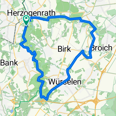
Rund um Merkstein mit Aufstieg
A cycling route starting in Herzogenrath, North Rhine-Westphalia, Germany.
Overview
About this route
Der Weg der Naturfreunde Merkstein „Rund um Merkstein“ wurde neu markiert. Er ist ingesamt 13 km lang.
Der komplette Weg wurde 1995 aus Anlass des 70. Bestehens der Naturfreunde-Merkstein bzw. zum 100. Bestehens der Mutter in Wien ausgewiesen und 2005 und 2019 aktualisiert. Auf diesen 3 Etappen werden wir 27 landschaftliche und kulturhistorische Merkwürdigkeiten kennenlernen, die schon 1995 von Peter Kuhn zusammengestellt wurden.
- -:--
- Duration
- 14.7 km
- Distance
- 180 m
- Ascent
- 182 m
- Descent
- ---
- Avg. speed
- ---
- Max. altitude

Route quality
Waytypes & surfaces along the route
Waytypes
Track
5.6 km
(38 %)
Quiet road
4.7 km
(32 %)
Surfaces
Paved
4.2 km
(29 %)
Unpaved
7.7 km
(53 %)
Gravel
4.3 km
(29 %)
Asphalt
3.7 km
(25 %)
Continue with Bikemap
Use, edit, or download this cycling route
You would like to ride Rund um Merkstein mit Aufstieg or customize it for your own trip? Here is what you can do with this Bikemap route:
Free features
- Save this route as favorite or in collections
- Copy & plan your own version of this route
- Sync your route with Garmin or Wahoo
Premium features
Free trial for 3 days, or one-time payment. More about Bikemap Premium.
- Navigate this route on iOS & Android
- Export a GPX / KML file of this route
- Create your custom printout (try it for free)
- Download this route for offline navigation
Discover more Premium features.
Get Bikemap PremiumFrom our community
Other popular routes starting in Herzogenrath
 AZAN Tour 4 Durch Den Norden Der Städteregion
- Distance
- 29.4 km
- Ascent
- 162 m
- Descent
- 163 m
- Location
- Herzogenrath, North Rhine-Westphalia, Germany
 West-Bike-Tagestour
- Distance
- 74.9 km
- Ascent
- 448 m
- Descent
- 445 m
- Location
- Herzogenrath, North Rhine-Westphalia, Germany
 Rund um den See
- Distance
- 40 km
- Ascent
- 127 m
- Descent
- 103 m
- Location
- Herzogenrath, North Rhine-Westphalia, Germany
 Tolle Landschaftsroute CLONED FROM ROUTE 220895
- Distance
- 25.5 km
- Ascent
- 162 m
- Descent
- 162 m
- Location
- Herzogenrath, North Rhine-Westphalia, Germany
 Brunsummer Heide Rodebach
- Distance
- 56 km
- Ascent
- 197 m
- Descent
- 218 m
- Location
- Herzogenrath, North Rhine-Westphalia, Germany
 Airbase Rund
- Distance
- 39.4 km
- Ascent
- 140 m
- Descent
- 154 m
- Location
- Herzogenrath, North Rhine-Westphalia, Germany
 Rund um Merkstein mit Aufstieg
- Distance
- 14.7 km
- Ascent
- 180 m
- Descent
- 182 m
- Location
- Herzogenrath, North Rhine-Westphalia, Germany
 WINFOR
- Distance
- 23.3 km
- Ascent
- 110 m
- Descent
- 120 m
- Location
- Herzogenrath, North Rhine-Westphalia, Germany
Open it in the app