

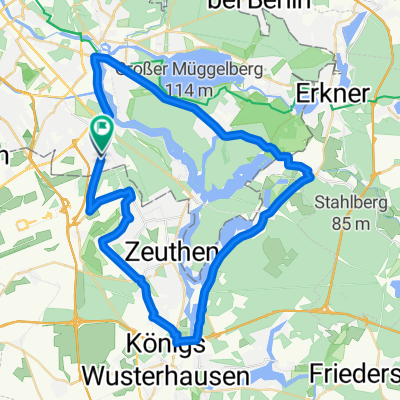
I tappa Hotel Grunau - Stazione Jungfernheide
A cycling route starting in Bohnsdorf, State of Berlin, Germany.
Overview
About this route
I tappa Hotel Grunau - Stazione Jungfernheide
- -:--
- Duration
- 49.7 km
- Distance
- 70 m
- Ascent
- 76 m
- Descent
- ---
- Avg. speed
- ---
- Max. altitude
Route quality
Waytypes & surfaces along the route
Waytypes
Quiet road
12.7 km
(26 %)
Pedestrian area
9.9 km
(20 %)
Surfaces
Paved
44.8 km
(90 %)
Unpaved
0.5 km
(<1 %)
Asphalt
40.1 km
(81 %)
Paving stones
4.2 km
(8 %)
Continue with Bikemap
Use, edit, or download this cycling route
You would like to ride I tappa Hotel Grunau - Stazione Jungfernheide or customize it for your own trip? Here is what you can do with this Bikemap route:
Free features
- Save this route as favorite or in collections
- Copy & plan your own version of this route
- Sync your route with Garmin or Wahoo
Premium features
Free trial for 3 days, or one-time payment. More about Bikemap Premium.
- Navigate this route on iOS & Android
- Export a GPX / KML file of this route
- Create your custom printout (try it for free)
- Download this route for offline navigation
Discover more Premium features.
Get Bikemap PremiumFrom our community
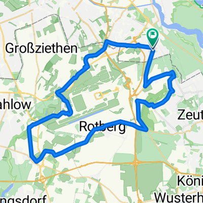
Other popular routes starting in Bohnsdorf
 I tappa Hotel Grunau - Stazione Jungfernheide
- Distance
- 49.7 km
- Ascent
- 70 m
- Descent
- 76 m
- Location
- Bohnsdorf, State of Berlin, Germany
 Waltersdorfer Straße 107, Berlin nach Waltersdorfer Straße 106, Berlin
- Distance
- 18.6 km
- Ascent
- 504 m
- Descent
- 503 m
- Location
- Bohnsdorf, State of Berlin, Germany
 50 km Wildau-Müggelsee Süd
- Distance
- 49 km
- Ascent
- 180 m
- Descent
- 181 m
- Location
- Bohnsdorf, State of Berlin, Germany
 Prieborner Straße 29, Berlin nach Prieborner Straße 29, Berlin
- Distance
- 8 km
- Ascent
- 16 m
- Descent
- 20 m
- Location
- Bohnsdorf, State of Berlin, Germany
 Dahme - Seddinsee
- Distance
- 37.6 km
- Ascent
- 135 m
- Descent
- 138 m
- Location
- Bohnsdorf, State of Berlin, Germany
 Wegendorf
- Distance
- 40.3 km
- Ascent
- 71 m
- Descent
- 40 m
- Location
- Bohnsdorf, State of Berlin, Germany
 Unbenannte Route
- Distance
- 42.1 km
- Ascent
- 99 m
- Descent
- 98 m
- Location
- Bohnsdorf, State of Berlin, Germany
 Dorfplatz15-Winckelmann56
- Distance
- 7.3 km
- Ascent
- 4 m
- Descent
- 19 m
- Location
- Bohnsdorf, State of Berlin, Germany
Open it in the app