

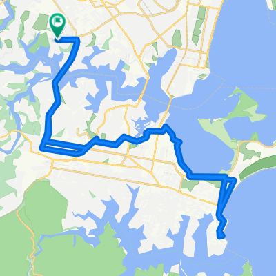
Moderate route in Oatley
A cycling route starting in Oatley, New South Wales, Australia.
Overview
About this route
- 48 min
- Duration
- 14 km
- Distance
- 231 m
- Ascent
- 224 m
- Descent
- 17.4 km/h
- Avg. speed
- ---
- Max. altitude
Continue with Bikemap
Use, edit, or download this cycling route
You would like to ride Moderate route in Oatley or customize it for your own trip? Here is what you can do with this Bikemap route:
Free features
- Save this route as favorite or in collections
- Copy & plan your own version of this route
- Sync your route with Garmin or Wahoo
Premium features
Free trial for 3 days, or one-time payment. More about Bikemap Premium.
- Navigate this route on iOS & Android
- Export a GPX / KML file of this route
- Create your custom printout (try it for free)
- Download this route for offline navigation
Discover more Premium features.
Get Bikemap PremiumFrom our community
Other popular routes starting in Oatley
 Route from Oatley Reserve
- Distance
- 9.7 km
- Ascent
- 78 m
- Descent
- 88 m
- Location
- Oatley, New South Wales, Australia
 Lloyd St at Mcintyre St, Oatley to Shelly Beach return
- Distance
- 45.1 km
- Ascent
- 331 m
- Descent
- 331 m
- Location
- Oatley, New South Wales, Australia
 Mi Mi Street 90A, Oatley to Riverwood return
- Distance
- 25.5 km
- Ascent
- 81 m
- Descent
- 87 m
- Location
- Oatley, New South Wales, Australia
 Route from 51 Lloyd Street, Oatley
- Distance
- 13 km
- Ascent
- 104 m
- Descent
- 139 m
- Location
- Oatley, New South Wales, Australia
 Trip home
- Distance
- 5 km
- Ascent
- 47 m
- Descent
- 54 m
- Location
- Oatley, New South Wales, Australia
 Oatley Sutherland
- Distance
- 6.7 km
- Ascent
- 134 m
- Descent
- 55 m
- Location
- Oatley, New South Wales, Australia
 Recovered Route
- Distance
- 4.4 km
- Ascent
- 58 m
- Descent
- 68 m
- Location
- Oatley, New South Wales, Australia
 Oatley to Taren Point via Como and Sutherland
- Distance
- 23.9 km
- Ascent
- 276 m
- Descent
- 275 m
- Location
- Oatley, New South Wales, Australia
Open it in the app