

Voggenberg-test
A cycling route starting in Aichkirchen, Upper Austria, Austria.
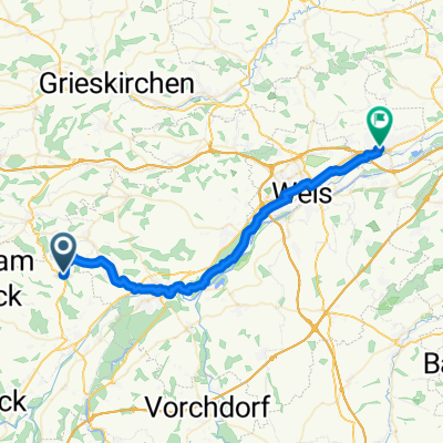
Overview
About this route
- 5 h 23 min
- Duration
- 85.6 km
- Distance
- 1,032 m
- Ascent
- 1,444 m
- Descent
- 15.9 km/h
- Avg. speed
- ---
- Max. altitude
Route quality
Waytypes & surfaces along the route
Waytypes
Quiet road
51.1 km
(60 %)
Road
23.2 km
(27 %)
Surfaces
Paved
46.9 km
(55 %)
Unpaved
2 km
(2 %)
Asphalt
46.8 km
(55 %)
Gravel
1.4 km
(2 %)
Continue with Bikemap
Use, edit, or download this cycling route
You would like to ride Voggenberg-test or customize it for your own trip? Here is what you can do with this Bikemap route:
Free features
- Save this route as favorite or in collections
- Copy & plan your own version of this route
- Split it into stages to create a multi-day tour
- Sync your route with Garmin or Wahoo
Premium features
Free trial for 3 days, or one-time payment. More about Bikemap Premium.
- Navigate this route on iOS & Android
- Export a GPX / KML file of this route
- Create your custom printout (try it for free)
- Download this route for offline navigation
Discover more Premium features.
Get Bikemap PremiumFrom our community
Other popular routes starting in Aichkirchen
 Bergstraße nach Welser Straße
- Distance
- 37.1 km
- Ascent
- 129 m
- Descent
- 259 m
- Location
- Aichkirchen, Upper Austria, Austria
 Proberunde
- Distance
- 17.2 km
- Ascent
- 136 m
- Descent
- 144 m
- Location
- Aichkirchen, Upper Austria, Austria
 Kematen Scharten Marchtrenk
- Distance
- 84.2 km
- Ascent
- 433 m
- Descent
- 433 m
- Location
- Aichkirchen, Upper Austria, Austria
 Kaitingerstraße 2–6, Niederthalheim nach Antoniusweg 11, Niederthalheim
- Distance
- 11.4 km
- Ascent
- 192 m
- Descent
- 164 m
- Location
- Aichkirchen, Upper Austria, Austria
 Voggenberg-test
- Distance
- 85.6 km
- Ascent
- 1,032 m
- Descent
- 1,444 m
- Location
- Aichkirchen, Upper Austria, Austria
 Reiterrunde
- Distance
- 59.7 km
- Ascent
- 469 m
- Descent
- 506 m
- Location
- Aichkirchen, Upper Austria, Austria
 Test Aichkirchen
- Distance
- 44.7 km
- Ascent
- 446 m
- Descent
- 439 m
- Location
- Aichkirchen, Upper Austria, Austria
 1. Tag Ahornböden
- Distance
- 72.6 km
- Ascent
- 474 m
- Descent
- 354 m
- Location
- Aichkirchen, Upper Austria, Austria
Open it in the app