

Ottawa - South of the city
Orleans - Sarsfield - Vars
A cycling route starting in Ottawa, Ontario, Canada.
Overview
About this route
To Orleans mostly on paved pathways, south to Sarsfield on quiet paved roads. Some pavement is a bit rough but this is a peaceful metric century.
- -:--
- Duration
- 102.9 km
- Distance
- 355 m
- Ascent
- 353 m
- Descent
- ---
- Avg. speed
- ---
- Max. altitude

Part of
Ottawa - South of the city
5 stages
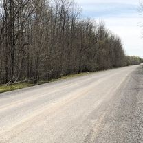
Route photos

Route quality
Waytypes & surfaces along the route
Waytypes
Quiet road
30.9 km
(30 %)
Road
19.6 km
(19 %)
Surfaces
Paved
100.8 km
(98 %)
Unpaved
2.1 km
(2 %)
Asphalt
90.6 km
(88 %)
Paved (undefined)
10.3 km
(10 %)
Continue with Bikemap
Use, edit, or download this cycling route
You would like to ride Orleans - Sarsfield - Vars or customize it for your own trip? Here is what you can do with this Bikemap route:
Free features
- Save this route as favorite or in collections
- Copy & plan your own version of this route
- Split it into stages to create a multi-day tour
- Sync your route with Garmin or Wahoo
Premium features
Free trial for 3 days, or one-time payment. More about Bikemap Premium.
- Navigate this route on iOS & Android
- Export a GPX / KML file of this route
- Create your custom printout (try it for free)
- Download this route for offline navigation
Discover more Premium features.
Get Bikemap PremiumFrom our community
Other popular routes starting in Ottawa
 Route to 373 Laurier Avenue East, Ottawa ON K1N 8X6
- Distance
- 20.8 km
- Ascent
- 192 m
- Descent
- 190 m
- Location
- Ottawa, Ontario, Canada
 South of Blackburn
- Distance
- 19.1 km
- Ascent
- 61 m
- Descent
- 61 m
- Location
- Ottawa, Ontario, Canada
 gat loop
- Distance
- 48.5 km
- Ascent
- 398 m
- Descent
- 397 m
- Location
- Ottawa, Ontario, Canada
 Metcalfe St, Ottawa to Metcalfe St, Ottawa
- Distance
- 29.3 km
- Ascent
- 149 m
- Descent
- 149 m
- Location
- Ottawa, Ontario, Canada
 PH to Steve's
- Distance
- 27.9 km
- Ascent
- 228 m
- Descent
- 246 m
- Location
- Ottawa, Ontario, Canada
 Italian Waters
- Distance
- 12.7 km
- Ascent
- 54 m
- Descent
- 55 m
- Location
- Ottawa, Ontario, Canada
 Morning Faux-Commute
- Distance
- 20.7 km
- Ascent
- 91 m
- Descent
- 92 m
- Location
- Ottawa, Ontario, Canada
 Route to Kichi Zībī Mīkan, Relais Kichi 27km
- Distance
- 27.4 km
- Ascent
- 225 m
- Descent
- 223 m
- Location
- Ottawa, Ontario, Canada
Open it in the app