

Fietsvakantie Adenau
Adenau-Stramproy
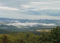
A cycling route starting in Adenau, Rhineland-Palatinate, Germany.
Overview
About this route
- -:--
- Duration
- 179.9 km
- Distance
- 2,227 m
- Ascent
- 2,498 m
- Descent
- ---
- Avg. speed
- ---
- Max. altitude

Part of
Fietsvakantie Adenau
4 stages
Route quality
Waytypes & surfaces along the route
Waytypes
Road
32.4 km
(18 %)
Quiet road
32.4 km
(18 %)
Surfaces
Paved
125.9 km
(70 %)
Unpaved
1.8 km
(1 %)
Asphalt
116.9 km
(65 %)
Paved (undefined)
7.2 km
(4 %)
Continue with Bikemap
Use, edit, or download this cycling route
You would like to ride Adenau-Stramproy or customize it for your own trip? Here is what you can do with this Bikemap route:
Free features
- Save this route as favorite or in collections
- Copy & plan your own version of this route
- Split it into stages to create a multi-day tour
- Sync your route with Garmin or Wahoo
Premium features
Free trial for 3 days, or one-time payment. More about Bikemap Premium.
- Navigate this route on iOS & Android
- Export a GPX / KML file of this route
- Create your custom printout (try it for free)
- Download this route for offline navigation
Discover more Premium features.
Get Bikemap PremiumFrom our community
Other popular routes starting in Adenau
 Bulls Achterbahn
- Distance
- 55 km
- Ascent
- 1,076 m
- Descent
- 1,077 m
- Location
- Adenau, Rhineland-Palatinate, Germany
 Um `n Ring
- Distance
- 27.3 km
- Ascent
- 677 m
- Descent
- 677 m
- Location
- Adenau, Rhineland-Palatinate, Germany
 Adenau-Stramproy
- Distance
- 179.9 km
- Ascent
- 2,227 m
- Descent
- 2,498 m
- Location
- Adenau, Rhineland-Palatinate, Germany
 Das Kelberger Land
- Distance
- 52.6 km
- Ascent
- 728 m
- Descent
- 727 m
- Location
- Adenau, Rhineland-Palatinate, Germany
 Relaxed Afternoon Track In Adenau
- Distance
- 32.4 km
- Ascent
- 732 m
- Descent
- 716 m
- Location
- Adenau, Rhineland-Palatinate, Germany
 Hohe Acht Anstieg II
- Distance
- 6.9 km
- Ascent
- 360 m
- Descent
- 8 m
- Location
- Adenau, Rhineland-Palatinate, Germany
 Nürburgring (Grüne Hölle)
- Distance
- 25.4 km
- Ascent
- 544 m
- Descent
- 544 m
- Location
- Adenau, Rhineland-Palatinate, Germany
 Hohe Acht
- Distance
- 16 km
- Ascent
- 408 m
- Descent
- 169 m
- Location
- Adenau, Rhineland-Palatinate, Germany
Open it in the app