

Manitou - gog- sinton - greenbelt - PP - M
A cycling route starting in Manitou Springs, Colorado, United States.
Overview
About this route
- 1 h 41 min
- Duration
- 27.9 km
- Distance
- 287 m
- Ascent
- 288 m
- Descent
- 16.6 km/h
- Avg. speed
- ---
- Max. altitude

Route quality
Waytypes & surfaces along the route
Waytypes
Cycleway
12 km
(43 %)
Quiet road
6.4 km
(23 %)
Surfaces
Paved
19.5 km
(70 %)
Unpaved
2.2 km
(8 %)
Asphalt
7.8 km
(28 %)
Concrete
7.8 km
(28 %)
Continue with Bikemap
Use, edit, or download this cycling route
You would like to ride Manitou - gog- sinton - greenbelt - PP - M or customize it for your own trip? Here is what you can do with this Bikemap route:
Free features
- Save this route as favorite or in collections
- Copy & plan your own version of this route
- Sync your route with Garmin or Wahoo
Premium features
Free trial for 3 days, or one-time payment. More about Bikemap Premium.
- Navigate this route on iOS & Android
- Export a GPX / KML file of this route
- Create your custom printout (try it for free)
- Download this route for offline navigation
Discover more Premium features.
Get Bikemap PremiumFrom our community
Other popular routes starting in Manitou Springs
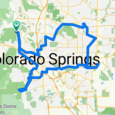
 Manitou - gog- sinton - greenbelt - PP - M
- Distance
- 27.9 km
- Ascent
- 287 m
- Descent
- 288 m
- Location
- Manitou Springs, Colorado, United States
 Ring the Springs (Clockwise Densified Route)
- Distance
- 70.5 km
- Ascent
- 690 m
- Descent
- 692 m
- Location
- Manitou Springs, Colorado, United States
 Single loop major through Garden of the Gods from home
- Distance
- 10.7 km
- Ascent
- 223 m
- Descent
- 245 m
- Location
- Manitou Springs, Colorado, United States
 Midland, pickle ball, pikes peak
- Distance
- 20.7 km
- Ascent
- 170 m
- Descent
- 163 m
- Location
- Manitou Springs, Colorado, United States
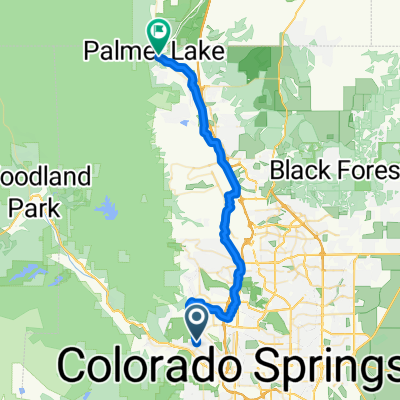
 From Garder of Gods to Monument
- Distance
- 71 km
- Ascent
- 2,484 m
- Descent
- 2,257 m
- Location
- Manitou Springs, Colorado, United States
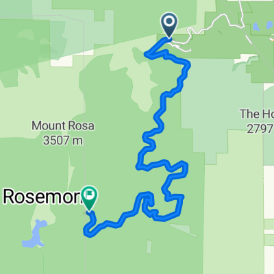 Gold Camp road Co.
- Distance
- 19.6 km
- Ascent
- 1,173 m
- Descent
- 468 m
- Location
- Manitou Springs, Colorado, United States
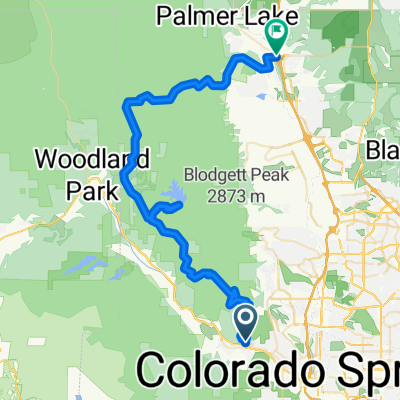
 Pleasant Street to O'Malley's Palmer Lake
- Distance
- 43.6 km
- Ascent
- 541 m
- Descent
- 221 m
- Location
- Manitou Springs, Colorado, United States
 Restful route in Colorado Springs
- Distance
- 8.7 km
- Ascent
- 33 m
- Descent
- 131 m
- Location
- Manitou Springs, Colorado, United States
Open it in the app