- 16.4 km
- 590 m
- 269 m
- Pievebovigliana, The Marches, Italy
LAME ROSSE
A cycling route starting in Pievebovigliana, The Marches, Italy.
Overview
About this route
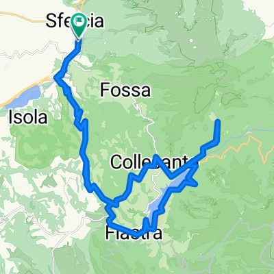
A beautiful route to discover the Lame Rosse.
The start is from the hamlet of Collemese, taking the gravel road that climbs up to the church of S. Maria Maddalena.
An equipped rest area invites you to take a break before moving on.
Continue along the path behind the church which ascends toward Mt. Fiegni.
After a fairly steep section, you change mountain slopes and begin descending along a fence. Soon you reach a clearing with the Fosso della Regina to the right. Stay on the right and take the almost flat path that leads to watering troughs for livestock. This path is to be followed until a wide, sloping clearing just past the Sottacqua spring.At the lowest point of this clearing, a path begins that descends through scrub and reconnects with the trail from Grotta dei Frati leading to the Lame Rosse.
To visit the Lame Rosse, you must leave your bikes and walk back up a few hundred meters.
The itinerary continues on a trail toward the dam of Lake Fiastra, reached after a steep climb. Continue ascending up to the "Ruffella" locality, then proceed to the settlement of Fiegni.
From there, the descent begins on an asphalt road back to Collemese.
- -:--
- Duration
- 20.3 km
- Distance
- 866 m
- Ascent
- 817 m
- Descent
- ---
- Avg. speed
- ---
- Max. altitude
created this 15 years ago
Continue with Bikemap
Use, edit, or download this cycling route
You would like to ride LAME ROSSE or customize it for your own trip? Here is what you can do with this Bikemap route:
Free features
- Save this route as favorite or in collections
- Copy & plan your own version of this route
- Sync your route with Garmin or Wahoo
Premium features
Free trial for 3 days, or one-time payment. More about Bikemap Premium.
- Navigate this route on iOS & Android
- Export a GPX / KML file of this route
- Create your custom printout (try it for free)
- Download this route for offline navigation
Discover more Premium features.
Get Bikemap PremiumFrom our community
Other popular routes starting in Pievebovigliana
- gffff
- Italy2020 E16b
- 74 km
- 1,628 m
- 1,464 m
- Pievebovigliana, The Marches, Italy
- Fistra
- 41.2 km
- 990 m
- 984 m
- Pievebovigliana, The Marches, Italy
- Monte Fiegni
- 19.4 km
- 925 m
- 925 m
- Pievebovigliana, The Marches, Italy
- Lago Polverina-Caccamo-Fiastrone-Sarnano
- 44.8 km
- 901 m
- 767 m
- Pievebovigliana, The Marches, Italy
- Polvrina - Fiastra - Sassotetto
- 55.1 km
- 1,355 m
- 1,379 m
- Pievebovigliana, The Marches, Italy
- Lago Polverina-Caccamo-Caldarola-Cessapalombo--Sarnano
- 49.2 km
- 819 m
- 683 m
- Pievebovigliana, The Marches, Italy
- ponte-gelagna-morro-camerino-sfercia
- 32.9 km
- 493 m
- 492 m
- Pievebovigliana, The Marches, Italy
Open it in the app


