

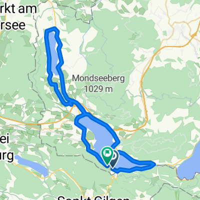
Eisenauclimb-Schwarzensee-Wolfgangsee-St.Gilgen
A cycling route starting in Sankt Lorenz, Upper Austria, Austria.
Overview
About this route
Cycled on 20.09.2019 with an E-Mountainbike
Recorded with Garmin Edge1030: 39.9 km - 770 m of ascent
After we parked the car, we immediately set off on the long climb to Eisenau. On wide paths, it was easy to ride up there. How much motor assistance to add is up to each rider. Personally, I kept it sporty with as little motor as possible. The views over Lake Mondsee were stunning. At Eisenau, there are 2 cozy mountain huts we did not visit. The descent was also enjoyable. Through a wide valley, we rode to Schwarzensee and continued to Wolfgangsee. Along the southern side of Wolfgangsee, we cycled towards St. Gilgen. We then headed towards Krotensee. There, you can enjoy various smoked fish along the roadside (not always open). Having conquered the last climb, we quickly descended back to the car.
- -:--
- Duration
- 38.9 km
- Distance
- 1,837 m
- Ascent
- 1,815 m
- Descent
- ---
- Avg. speed
- ---
- Max. altitude
Route photos


Route quality
Waytypes & surfaces along the route
Waytypes
Track
15.2 km
(39 %)
Quiet road
6.2 km
(16 %)
Surfaces
Paved
21 km
(54 %)
Unpaved
16.7 km
(43 %)
Asphalt
21 km
(54 %)
Gravel
15.9 km
(41 %)
Continue with Bikemap
Use, edit, or download this cycling route
You would like to ride Eisenauclimb-Schwarzensee-Wolfgangsee-St.Gilgen or customize it for your own trip? Here is what you can do with this Bikemap route:
Free features
- Save this route as favorite or in collections
- Copy & plan your own version of this route
- Sync your route with Garmin or Wahoo
Premium features
Free trial for 3 days, or one-time payment. More about Bikemap Premium.
- Navigate this route on iOS & Android
- Export a GPX / KML file of this route
- Create your custom printout (try it for free)
- Download this route for offline navigation
Discover more Premium features.
Get Bikemap PremiumFrom our community
Other popular routes starting in Sankt Lorenz
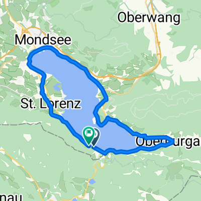 Mondsee kör
- Distance
- 25.5 km
- Ascent
- 494 m
- Descent
- 485 m
- Location
- Sankt Lorenz, Upper Austria, Austria
 Mondseerunde
- Distance
- 32.9 km
- Ascent
- 1,043 m
- Descent
- 1,041 m
- Location
- Sankt Lorenz, Upper Austria, Austria
 Schafbergrunde CLONED FROM ROUTE 648239
- Distance
- 34.7 km
- Ascent
- 1,185 m
- Descent
- 1,185 m
- Location
- Sankt Lorenz, Upper Austria, Austria
 Unbenannte Route
- Distance
- 19.9 km
- Ascent
- 302 m
- Descent
- 225 m
- Location
- Sankt Lorenz, Upper Austria, Austria
 Schafberg
- Distance
- 13.5 km
- Ascent
- 972 m
- Descent
- 971 m
- Location
- Sankt Lorenz, Upper Austria, Austria
 Mondsee+Irrsee körút
- Distance
- 50.1 km
- Ascent
- 733 m
- Descent
- 710 m
- Location
- Sankt Lorenz, Upper Austria, Austria
 Eisenauclimb-Schwarzensee-Wolfgangsee-St.Gilgen
- Distance
- 38.9 km
- Ascent
- 1,837 m
- Descent
- 1,815 m
- Location
- Sankt Lorenz, Upper Austria, Austria
 okolo 3 jazier
- Distance
- 62 km
- Ascent
- 412 m
- Descent
- 412 m
- Location
- Sankt Lorenz, Upper Austria, Austria
Open it in the app