

Carroll Vista to Butterburg Inn
A cycling route starting in Taneytown, Maryland, United States of America.
Overview
About this route
- 9 h 58 min
- Duration
- 26.4 km
- Distance
- 1,722 m
- Ascent
- 1,736 m
- Descent
- 2.7 km/h
- Avg. speed
- ---
- Max. altitude
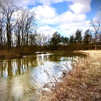
Route photos


Route quality
Waytypes & surfaces along the route
Waytypes
Road
10.6 km
(40 %)
Quiet road
8 km
(30 %)
Surfaces
Paved
5.9 km
(22 %)
Unpaved
4.6 km
(17 %)
Asphalt
5.8 km
(22 %)
Gravel
4.6 km
(17 %)
Continue with Bikemap
Use, edit, or download this cycling route
You would like to ride Carroll Vista to Butterburg Inn or customize it for your own trip? Here is what you can do with this Bikemap route:
Free features
- Save this route as favorite or in collections
- Copy & plan your own version of this route
- Sync your route with Garmin or Wahoo
Premium features
Free trial for 3 days, or one-time payment. More about Bikemap Premium.
- Navigate this route on iOS & Android
- Export a GPX / KML file of this route
- Create your custom printout (try it for free)
- Download this route for offline navigation
Discover more Premium features.
Get Bikemap PremiumFrom our community
Other popular routes starting in Taneytown
 Harney Union Bridge
- Distance
- 68.5 km
- Ascent
- 372 m
- Descent
- 372 m
- Location
- Taneytown, Maryland, United States of America
 Harney – Sam's Creek
- Distance
- 104 km
- Ascent
- 497 m
- Descent
- 497 m
- Location
- Taneytown, Maryland, United States of America
 1611 S Keysville Rd, Keymar to 1700–1704 S Keysville Rd, Keymar
- Distance
- 27.5 km
- Ascent
- 278 m
- Descent
- 278 m
- Location
- Taneytown, Maryland, United States of America
 Francis Scott Key Highway 3481, Taneytown to Mayberry Road 2562, Westminster
- Distance
- 9 km
- Ascent
- 82 m
- Descent
- 68 m
- Location
- Taneytown, Maryland, United States of America
 225 Savannah Dr, Gettysburg to 225 Savannah Dr, Gettysburg
- Distance
- 6.3 km
- Ascent
- 4 m
- Descent
- 6 m
- Location
- Taneytown, Maryland, United States of America
 1611 S Keysville Rd, Keymar to 3907 Old Taneytown Rd, Taneytown
- Distance
- 17.3 km
- Ascent
- 202 m
- Descent
- 216 m
- Location
- Taneytown, Maryland, United States of America
 Francis Scott Key Highway 1610, Keymar to Francis Scott Key Highway 3481, Taneytown
- Distance
- 8.4 km
- Ascent
- 69 m
- Descent
- 58 m
- Location
- Taneytown, Maryland, United States of America
 Carroll Vista to Butterburg Inn
- Distance
- 26.4 km
- Ascent
- 1,722 m
- Descent
- 1,736 m
- Location
- Taneytown, Maryland, United States of America
Open it in the app