
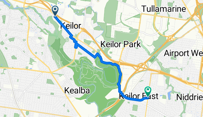
931 Old Calder Highway, Keilor to 134 Milleara Road, Keilor East
A cycling route starting in Keilor Lodge, Victoria, Australia.
Overview
About this route
- 24 min
- Duration
- 7.1 km
- Distance
- 85 m
- Ascent
- 99 m
- Descent
- 18 km/h
- Avg. speed
- ---
- Avg. speed
Route quality
Waytypes & surfaces along the route
Waytypes
Quiet road
3.2 km
(45 %)
Cycleway
3.1 km
(44 %)
Surfaces
Paved
6.6 km
(93 %)
Asphalt
3.1 km
(43 %)
Paved (undefined)
1.8 km
(25 %)
Continue with Bikemap
Use, edit, or download this cycling route
You would like to ride 931 Old Calder Highway, Keilor to 134 Milleara Road, Keilor East or customize it for your own trip? Here is what you can do with this Bikemap route:
Free features
- Save this route as favorite or in collections
- Copy & plan your own version of this route
- Sync your route with Garmin or Wahoo
Premium features
Free trial for 3 days, or one-time payment. More about Bikemap Premium.
- Navigate this route on iOS & Android
- Export a GPX / KML file of this route
- Create your custom printout (try it for free)
- Download this route for offline navigation
Discover more Premium features.
Get Bikemap PremiumFrom our community
Other popular routes starting in Keilor Lodge
 Airport to Belgrave
- Distance
- 64 km
- Ascent
- 632 m
- Descent
- 523 m
- Location
- Keilor Lodge, Victoria, Australia
 Slow ride in Keilor Downs
- Distance
- 8.7 km
- Ascent
- 40 m
- Descent
- 41 m
- Location
- Keilor Lodge, Victoria, Australia
 Easy ride in Keilor Lodge
- Distance
- 1.2 km
- Ascent
- 8 m
- Descent
- 0 m
- Location
- Keilor Lodge, Victoria, Australia
 Sunshine Avenue, Keilor to , Keilor East
- Distance
- 9.8 km
- Ascent
- 144 m
- Descent
- 212 m
- Location
- Keilor Lodge, Victoria, Australia
 Keilor Downs to Essendon Fields
- Distance
- 15 km
- Ascent
- 117 m
- Descent
- 134 m
- Location
- Keilor Lodge, Victoria, Australia
 931 Old Calder Highway, Keilor to 134 Milleara Road, Keilor East
- Distance
- 7.1 km
- Ascent
- 85 m
- Descent
- 99 m
- Location
- Keilor Lodge, Victoria, Australia
 march 12
- Distance
- 43.3 km
- Ascent
- 477 m
- Descent
- 153 m
- Location
- Keilor Lodge, Victoria, Australia
 Melton Highway 15, Taylors Lakes to Matthews Avenue 67C, Airport West
- Distance
- 13.3 km
- Ascent
- 91 m
- Descent
- 104 m
- Location
- Keilor Lodge, Victoria, Australia
Open it in the app