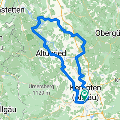
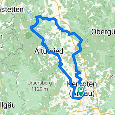
Allgäu - Berge satt im Oberallgäu (2)
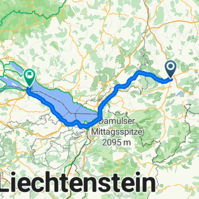
A cycling route starting in Kempten (Allgäu), Bavaria, Germany.
Overview
About this route
Diese anspruchsvolle Radtour bietet Bergsicht pur und zahlreiche Höhenmeter. Wer die sportliche Herausforderung sucht, ist hier richtig. Mit „den Bergen vor der Nase und in den Beinen“ geht es von Kempten auf aussichtsreicher Strecke in die Berglandschaft des südlichen Oberallgäus und über die österreichische Enklave Jungholz in das nördliche Alpenvorland zurück. (Tourbeschreibung unter: thod_er@gmx.de)
- -:--
- Duration
- 72.4 km
- Distance
- 985 m
- Ascent
- 982 m
- Descent
- ---
- Avg. speed
- ---
- Avg. speed
Route quality
Waytypes & surfaces along the route
Waytypes
Quiet road
23.1 km
(32 %)
Busy road
15.8 km
(22 %)
Surfaces
Paved
56.5 km
(78 %)
Unpaved
6.9 km
(10 %)
Asphalt
54.3 km
(75 %)
Gravel
5.5 km
(8 %)
Continue with Bikemap
Use, edit, or download this cycling route
You would like to ride Allgäu - Berge satt im Oberallgäu (2) or customize it for your own trip? Here is what you can do with this Bikemap route:
Free features
- Save this route as favorite or in collections
- Copy & plan your own version of this route
- Sync your route with Garmin or Wahoo
Premium features
Free trial for 3 days, or one-time payment. More about Bikemap Premium.
- Navigate this route on iOS & Android
- Export a GPX / KML file of this route
- Create your custom printout (try it for free)
- Download this route for offline navigation
Discover more Premium features.
Get Bikemap PremiumFrom our community
Other popular routes starting in Kempten (Allgäu)
- Alpencross III - Passo dello Stelvio
- Distance
- 428.2 km
- Ascent
- 3,410 m
- Descent
- 3,858 m
- Location
- Kempten (Allgäu), Bavaria, Germany
- Kempten-Oberstdorf
- Distance
- 50.8 km
- Ascent
- 460 m
- Descent
- 338 m
- Location
- Kempten (Allgäu), Bavaria, Germany
- diepolz rettenberg
- Distance
- 62.6 km
- Ascent
- 689 m
- Descent
- 690 m
- Location
- Kempten (Allgäu), Bavaria, Germany
- Trainingsrunde
- Distance
- 41.5 km
- Ascent
- 750 m
- Descent
- 754 m
- Location
- Kempten (Allgäu), Bavaria, Germany
- Von Kempten über Hauchenberg Niedersonthofen nach Kempten
- Distance
- 55.8 km
- Ascent
- 882 m
- Descent
- 872 m
- Location
- Kempten (Allgäu), Bavaria, Germany
- Sonntags-Katertour
- Distance
- 53.7 km
- Ascent
- 1,107 m
- Descent
- 1,107 m
- Location
- Kempten (Allgäu), Bavaria, Germany
- Nord-West Runde Kempten
- Distance
- 59.3 km
- Ascent
- 656 m
- Descent
- 664 m
- Location
- Kempten (Allgäu), Bavaria, Germany
- Kempten-Jochpaß-Grän-Pfronten-Kempten
- Distance
- 106.7 km
- Ascent
- 1,185 m
- Descent
- 1,070 m
- Location
- Kempten (Allgäu), Bavaria, Germany
Open it in the app