

Schwarzwald Panorama Weg
A cycling route starting in Pforzheim, Baden-Württemberg, Germany.
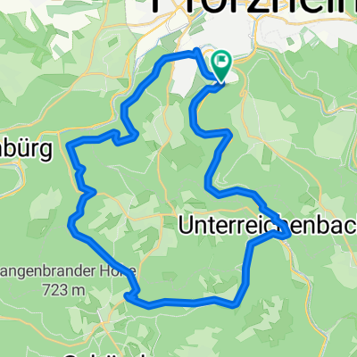
Overview
About this route
Nach dem Motto „viel Schwarzwald - noch mehr Panorama“ führt der Schwarzwald Panorama-Radweg über die schönsten Höhen auf der Ostseite des Mittelgebirges. Der Schwarzwald Panorama-Radweg verbindet Nord- und Südschwarzwald. Durch romantische Flusstäler und über Höhenrücken mit wunderbaren Aussichten radelt man durch zwei Naturparks, trifft auf typische Gehöfte und den eiszeitlichen Titisee. (Tourbeschreibung unter: thod_er@gmx.de)
- -:--
- Duration
- 282.9 km
- Distance
- 7,910 m
- Ascent
- 7,507 m
- Descent
- ---
- Avg. speed
- ---
- Avg. speed
Route quality
Waytypes & surfaces along the route
Waytypes
Quiet road
94.3 km
(33 %)
Track
86.5 km
(31 %)
Surfaces
Paved
187.4 km
(66 %)
Unpaved
62.9 km
(22 %)
Asphalt
166.7 km
(59 %)
Gravel
35.5 km
(13 %)
Continue with Bikemap
Use, edit, or download this cycling route
You would like to ride Schwarzwald Panorama Weg or customize it for your own trip? Here is what you can do with this Bikemap route:
Free features
- Save this route as favorite or in collections
- Copy & plan your own version of this route
- Split it into stages to create a multi-day tour
- Sync your route with Garmin or Wahoo
Premium features
Free trial for 3 days, or one-time payment. More about Bikemap Premium.
- Navigate this route on iOS & Android
- Export a GPX / KML file of this route
- Create your custom printout (try it for free)
- Download this route for offline navigation
Discover more Premium features.
Get Bikemap PremiumFrom our community
Other popular routes starting in Pforzheim
 Nagoldtal-Würmtal-Runde
- Distance
- 49.4 km
- Ascent
- 605 m
- Descent
- 605 m
- Location
- Pforzheim, Baden-Württemberg, Germany
 Wasserleitungsweg, Grösseltal, Eulenbachtal UR
- Distance
- 30.6 km
- Ascent
- 495 m
- Descent
- 494 m
- Location
- Pforzheim, Baden-Württemberg, Germany
 Um den Hohberg
- Distance
- 12.4 km
- Ascent
- 160 m
- Descent
- 149 m
- Location
- Pforzheim, Baden-Württemberg, Germany
 Pforzheim - Lossburg
- Distance
- 85 km
- Ascent
- 925 m
- Descent
- 521 m
- Location
- Pforzheim, Baden-Württemberg, Germany
 dillstein grössel langenbrand U.reichenbach
- Distance
- 31.2 km
- Ascent
- 517 m
- Descent
- 516 m
- Location
- Pforzheim, Baden-Württemberg, Germany
 MTB - Würm-Valley@18:30pm
- Distance
- 20.9 km
- Ascent
- 519 m
- Descent
- 519 m
- Location
- Pforzheim, Baden-Württemberg, Germany
 Pforzheim - Loßburg
- Distance
- 107.2 km
- Ascent
- 1,198 m
- Descent
- 773 m
- Location
- Pforzheim, Baden-Württemberg, Germany
 Route zu Die Halde
- Distance
- 195.2 km
- Ascent
- 4,988 m
- Descent
- 4,109 m
- Location
- Pforzheim, Baden-Württemberg, Germany
Open it in the app