

HF R Siebnen-Sattelegg-Ibergeregg
A cycling route starting in Schübelbach, Canton of Schwyz, Switzerland.
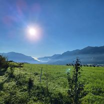
Overview
About this route
Siebnen-Vorderthal-Sattelegg-Willerzell-Euthal-Studen-Unteriberg-Oberiberg-Ibergeregg- Bergrestaurant Sonnenhütte
- -:--
- Duration
- 39.7 km
- Distance
- 1,331 m
- Ascent
- 353 m
- Descent
- ---
- Avg. speed
- ---
- Max. altitude
Route quality
Waytypes & surfaces along the route
Waytypes
Road
15.9 km
(40 %)
Quiet road
12.3 km
(31 %)
Surfaces
Paved
21 km
(53 %)
Unpaved
0.4 km
(1 %)
Asphalt
21 km
(53 %)
Gravel
0.4 km
(1 %)
Undefined
18.3 km
(46 %)
Continue with Bikemap
Use, edit, or download this cycling route
You would like to ride HF R Siebnen-Sattelegg-Ibergeregg or customize it for your own trip? Here is what you can do with this Bikemap route:
Free features
- Save this route as favorite or in collections
- Copy & plan your own version of this route
- Sync your route with Garmin or Wahoo
Premium features
Free trial for 3 days, or one-time payment. More about Bikemap Premium.
- Navigate this route on iOS & Android
- Export a GPX / KML file of this route
- Create your custom printout (try it for free)
- Download this route for offline navigation
Discover more Premium features.
Get Bikemap PremiumFrom our community
Other popular routes starting in Schübelbach
 Siebnen-Buchberg Technik
- Distance
- 22.6 km
- Ascent
- 273 m
- Descent
- 273 m
- Location
- Schübelbach, Canton of Schwyz, Switzerland
 HF R Siebnen-Sattelegg-Ibergeregg
- Distance
- 39.7 km
- Ascent
- 1,331 m
- Descent
- 353 m
- Location
- Schübelbach, Canton of Schwyz, Switzerland
 Knobelstrasse nach Mühlestrasse
- Distance
- 31.1 km
- Ascent
- 158 m
- Descent
- 206 m
- Location
- Schübelbach, Canton of Schwyz, Switzerland
 Siebnen - Schwendenen
- Distance
- 7.3 km
- Ascent
- 436 m
- Descent
- 158 m
- Location
- Schübelbach, Canton of Schwyz, Switzerland
 Sattelegg, Ibergeregg, Hirzel
- Distance
- 115.4 km
- Ascent
- 1,640 m
- Descent
- 1,641 m
- Location
- Schübelbach, Canton of Schwyz, Switzerland
 zackige Abendrunde mit tricki Abfahrt
- Distance
- 27.6 km
- Ascent
- 984 m
- Descent
- 984 m
- Location
- Schübelbach, Canton of Schwyz, Switzerland
 Siebnen Murg Kerenzerberg Siebnen
- Distance
- 65.4 km
- Ascent
- 724 m
- Descent
- 720 m
- Location
- Schübelbach, Canton of Schwyz, Switzerland
 Wäggital West Unpaved
- Distance
- 41.4 km
- Ascent
- 1,297 m
- Descent
- 1,297 m
- Location
- Schübelbach, Canton of Schwyz, Switzerland
Open it in the app