

Stupferich - am Rande des Nordschwarzwaldes
A cycling route starting in Königsbach-Stein, Baden-Wurttemberg, Germany.
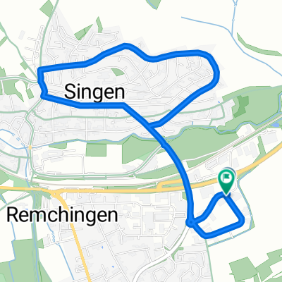
Overview
About this route
Pfinztal - Remchingen - Grötzingen - Ettlingen - Reichenbach - Langensteinbach - Eilferdingen
- -:--
- Duration
- 39.2 km
- Distance
- 249 m
- Ascent
- 252 m
- Descent
- ---
- Avg. speed
- 291 m
- Max. altitude
Route quality
Waytypes & surfaces along the route
Waytypes
Quiet road
9.8 km
(25 %)
Path
7.1 km
(18 %)
Surfaces
Paved
34.9 km
(89 %)
Unpaved
0.8 km
(2 %)
Asphalt
34.9 km
(89 %)
Gravel
0.8 km
(2 %)
Undefined
3.5 km
(9 %)
Continue with Bikemap
Use, edit, or download this cycling route
You would like to ride Stupferich - am Rande des Nordschwarzwaldes or customize it for your own trip? Here is what you can do with this Bikemap route:
Free features
- Save this route as favorite or in collections
- Copy & plan your own version of this route
- Sync your route with Garmin or Wahoo
Premium features
Free trial for 3 days, or one-time payment. More about Bikemap Premium.
- Navigate this route on iOS & Android
- Export a GPX / KML file of this route
- Create your custom printout (try it for free)
- Download this route for offline navigation
Discover more Premium features.
Get Bikemap PremiumFrom our community
Other popular routes starting in Königsbach-Stein
 Langensteinbach
- Distance
- 29.3 km
- Ascent
- 331 m
- Descent
- 331 m
- Location
- Königsbach-Stein, Baden-Wurttemberg, Germany
 Hopfenbergtour
- Distance
- 18.6 km
- Ascent
- 392 m
- Descent
- 392 m
- Location
- Königsbach-Stein, Baden-Wurttemberg, Germany
 Stupferich - am Rande des Nordschwarzwaldes
- Distance
- 39.2 km
- Ascent
- 249 m
- Descent
- 252 m
- Location
- Königsbach-Stein, Baden-Wurttemberg, Germany
 Obstwiesenrunde
- Distance
- 2.2 km
- Ascent
- 45 m
- Descent
- 44 m
- Location
- Königsbach-Stein, Baden-Wurttemberg, Germany
 Waldrundfahrt
- Distance
- 47.5 km
- Ascent
- 586 m
- Descent
- 586 m
- Location
- Königsbach-Stein, Baden-Wurttemberg, Germany
 Königsbach - Rhein (Leimersheim) - Karlsruhe - Königsbach
- Distance
- 70.7 km
- Ascent
- 127 m
- Descent
- 121 m
- Location
- Königsbach-Stein, Baden-Wurttemberg, Germany
 Cycle Sport Probefahrt
- Distance
- 4.7 km
- Ascent
- 72 m
- Descent
- 71 m
- Location
- Königsbach-Stein, Baden-Wurttemberg, Germany
 Ranntal - Ellmendingen
- Distance
- 8.1 km
- Ascent
- 134 m
- Descent
- 137 m
- Location
- Königsbach-Stein, Baden-Wurttemberg, Germany
Open it in the app