

Hagenberg, Schmidsberg, Oberaich - Gemütlich rauf und spannend runter
A cycling route starting in Engerwitzdorf, Upper Austria, Austria.
Overview
About this route
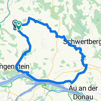
Nice paved path uphill, at Schmidsberg then the turn towards the Waldweg-Downhill. There are light roots and a few small stones. From here it’s almost all downhill. At Oberaich, there is a short high-speed section, after which you can also manage a small climb with the big chainring in front. Then switch over to Anitzberg and go along a singletrail into the Visnitz valley, over small bridges and along the slope by the rushing stream. Then paved again, gently uphill on the Teichweg towards Hagenberg.
- -:--
- Duration
- 9.4 km
- Distance
- 205 m
- Ascent
- 205 m
- Descent
- ---
- Avg. speed
- ---
- Max. altitude
Continue with Bikemap
Use, edit, or download this cycling route
You would like to ride Hagenberg, Schmidsberg, Oberaich - Gemütlich rauf und spannend runter or customize it for your own trip? Here is what you can do with this Bikemap route:
Free features
- Save this route as favorite or in collections
- Copy & plan your own version of this route
- Sync your route with Garmin or Wahoo
Premium features
Free trial for 3 days, or one-time payment. More about Bikemap Premium.
- Navigate this route on iOS & Android
- Export a GPX / KML file of this route
- Create your custom printout (try it for free)
- Download this route for offline navigation
Discover more Premium features.
Get Bikemap PremiumFrom our community
Other popular routes starting in Engerwitzdorf
 Runde Pregarten-Reichenstein-Pregarten
- Distance
- 17.8 km
- Ascent
- 346 m
- Descent
- 342 m
- Location
- Engerwitzdorf, Upper Austria, Austria
 MB-Schwarzbergerhofrunde
- Distance
- 56.9 km
- Ascent
- 854 m
- Descent
- 861 m
- Location
- Engerwitzdorf, Upper Austria, Austria
 Haid - Enns - Mur - Görtschitz - Klagenfurt
- Distance
- 337.6 km
- Ascent
- 1,553 m
- Descent
- 1,499 m
- Location
- Engerwitzdorf, Upper Austria, Austria
 Kollmitzberg - Neustadtl
- Distance
- 113.4 km
- Ascent
- 545 m
- Descent
- 542 m
- Location
- Engerwitzdorf, Upper Austria, Austria
 Aisttal 1, Pregarten nach Aisttal 1, Pregarten
- Distance
- 12.2 km
- Ascent
- 279 m
- Descent
- 282 m
- Location
- Engerwitzdorf, Upper Austria, Austria
 Pregarten-Krumau
- Distance
- 74 km
- Ascent
- 545 m
- Descent
- 499 m
- Location
- Engerwitzdorf, Upper Austria, Austria
 Runde Pregarten-Reichenstein-Pregarten
- Distance
- 17.8 km
- Ascent
- 369 m
- Descent
- 366 m
- Location
- Engerwitzdorf, Upper Austria, Austria
 Lungitz nach Weigersdorf
- Distance
- 29 km
- Ascent
- 274 m
- Descent
- 262 m
- Location
- Engerwitzdorf, Upper Austria, Austria
Open it in the app