

Wertach Radweg ab Tannh Tal (2 Tg)
A cycling route starting in Tannheim, Tyrol, Austria.
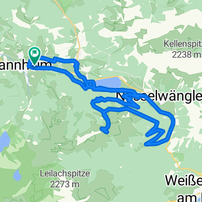
Overview
About this route
Der Fernradweg "Wertach erleben" verläuft entlang des Flusses vom Ursprung bis zur Mündung über eine Strecke von ca. 145 km von Oberjoch bis Augsburg. Die Wertach, der zweitlängste Fluss im Allgäu, entspringt aus zwei kleinen Bächen in Oberjoch. Der offizielle Start des ausgewiesenen Radweges ist in Oberjoch. Zwischen Oberjoch und Unterjoch liegt der Ursprung der Wertach. (Tourbeschreibung unter: thod_er@gmx.de)
- -:--
- Duration
- 152 km
- Distance
- 811 m
- Ascent
- 1,413 m
- Descent
- ---
- Avg. speed
- ---
- Max. altitude
Route quality
Waytypes & surfaces along the route
Waytypes
Track
62.3 km
(41 %)
Path
38 km
(25 %)
Surfaces
Paved
62.6 km
(41 %)
Unpaved
61.8 km
(41 %)
Asphalt
50.1 km
(33 %)
Gravel
30.8 km
(20 %)
Continue with Bikemap
Use, edit, or download this cycling route
You would like to ride Wertach Radweg ab Tannh Tal (2 Tg) or customize it for your own trip? Here is what you can do with this Bikemap route:
Free features
- Save this route as favorite or in collections
- Copy & plan your own version of this route
- Split it into stages to create a multi-day tour
- Sync your route with Garmin or Wahoo
Premium features
Free trial for 3 days, or one-time payment. More about Bikemap Premium.
- Navigate this route on iOS & Android
- Export a GPX / KML file of this route
- Create your custom printout (try it for free)
- Download this route for offline navigation
Discover more Premium features.
Get Bikemap PremiumFrom our community
Other popular routes starting in Tannheim
 Tannheim-Haldensee
- Distance
- 35.6 km
- Ascent
- 726 m
- Descent
- 726 m
- Location
- Tannheim, Tyrol, Austria
 Tannheim-Pronten-Reutte-Berwang-Namlos-Tannheim
- Distance
- 105 km
- Ascent
- 1,011 m
- Descent
- 1,012 m
- Location
- Tannheim, Tyrol, Austria
 Radltour in Tannheim
- Distance
- 50.8 km
- Ascent
- 289 m
- Descent
- 513 m
- Location
- Tannheim, Tyrol, Austria
 Tannheim Jungholz Tannheim
- Distance
- 40.2 km
- Ascent
- 459 m
- Descent
- 460 m
- Location
- Tannheim, Tyrol, Austria
 Tour Strinden Alpe
- Distance
- 23.7 km
- Ascent
- 948 m
- Descent
- 948 m
- Location
- Tannheim, Tyrol, Austria
 RSC TTal - 2 Seen Tour
- Distance
- 27.1 km
- Ascent
- 369 m
- Descent
- 369 m
- Location
- Tannheim, Tyrol, Austria
 Allgäu-Runde mittel
- Distance
- 124.3 km
- Ascent
- 820 m
- Descent
- 821 m
- Location
- Tannheim, Tyrol, Austria
 Vorarlbergrunde
- Distance
- 166.2 km
- Ascent
- 2,190 m
- Descent
- 2,190 m
- Location
- Tannheim, Tyrol, Austria
Open it in the app