Trip 6
- 2,021.9 km
- 2,359 m
- 1,651 m
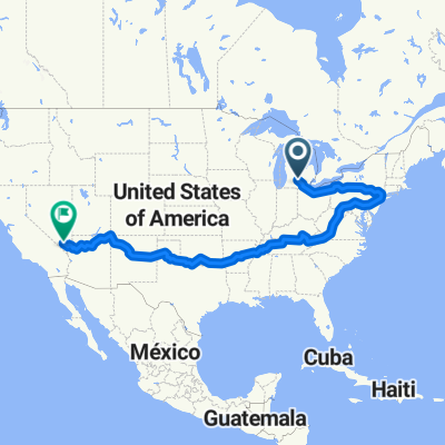
- Eaton Rapids, Michigan, United States
A cycling route starting in Eaton Rapids, Michigan, United States.
Overview
maumee bay to rock and roll hall of fame
created this 5 years ago
Route quality
Road
162.5 km
(42 %)
Cycleway
100.6 km
(26 %)
Paved
232.1 km
(60 %)
Unpaved
34.8 km
(9 %)
Asphalt
119.9 km
(31 %)
Paved (undefined)
108.3 km
(28 %)
Continue with Bikemap
You would like to ride Trip 2 or customize it for your own trip? Here is what you can do with this Bikemap route:
Free trial for 3 days, or one-time payment. More about Bikemap Premium.
Discover more Premium features.
Get Bikemap PremiumFrom our community
Open it in the app