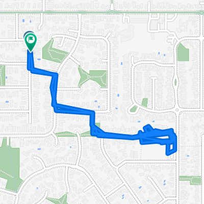
- 24.9 km
- 111 m
- 131 m
- Wantirna South, Victoria, Australia
Dandenong Police Paddock Eastlink Trail
A cycling route starting in Wantirna South, Victoria, Australia.
Overview
About this route
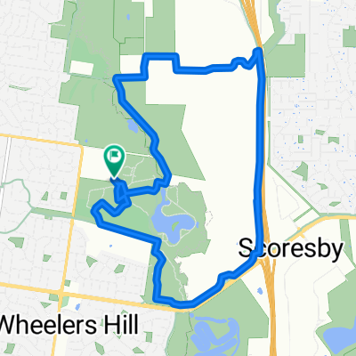
The route starts through EastLink Trail going to Yarraman Train station. Continue Eastlink trail until it meets Dandenong Creek Trail turning towards Dandenong Park. Returning to the Eastlink Trail via Police Paddock. Rejoining the Eastlink Trail at the Eastlink out-Police Ramp off.
One can go off the Wellington Trail towards the Eastlink Northbound Eastlink Service Centre, Scoresby for Coffee.
- -:--
- Duration
- 41.3 km
- Distance
- 146 m
- Ascent
- 146 m
- Descent
- ---
- Avg. speed
- ---
- Max. altitude
created this 5 years ago
Route quality
Waytypes & surfaces along the route
Waytypes
Cycleway
38.4 km
(93 %)
Quiet road
1.2 km
(3 %)
Surfaces
Paved
38 km
(92 %)
Unpaved
0.4 km
(1 %)
Concrete
20.2 km
(49 %)
Paved (undefined)
12.8 km
(31 %)
Continue with Bikemap
Use, edit, or download this cycling route
You would like to ride Dandenong Police Paddock Eastlink Trail or customize it for your own trip? Here is what you can do with this Bikemap route:
Free features
- Save this route as favorite or in collections
- Copy & plan your own version of this route
- Sync your route with Garmin or Wahoo
Premium features
Free trial for 3 days, or one-time payment. More about Bikemap Premium.
- Navigate this route on iOS & Android
- Export a GPX / KML file of this route
- Create your custom printout (try it for free)
- Download this route for offline navigation
Discover more Premium features.
Get Bikemap PremiumFrom our community
Other popular routes starting in Wantirna South
- Knox-FTG-Rowville
- Jells Park via Dandenong & Tarralla Creek trail.
- 42.1 km
- 162 m
- 155 m
- Wantirna South, Victoria, Australia
- Alchester Village Road - 40km return
- 37.8 km
- 144 m
- 146 m
- Wantirna South, Victoria, Australia
- Walsh Avenue to Walsh Avenue
- 4.7 km
- 45 m
- 49 m
- Wantirna South, Victoria, Australia
- hash wantirna south
- 10.5 km
- 50 m
- 51 m
- Wantirna South, Victoria, Australia
- Walsh Avenue to Oxford Street
- 12.1 km
- 195 m
- 188 m
- Wantirna South, Victoria, Australia
- Lilydale
- 21.5 km
- 160 m
- 150 m
- Wantirna South, Victoria, Australia
- Mulgrave Ward, Wheelers Hill to Mulgrave Ward, Wheelers Hill
- 10.9 km
- 102 m
- 104 m
- Wantirna South, Victoria, Australia
Open it in the app


