

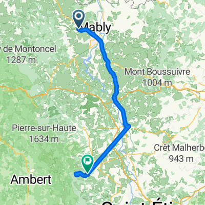
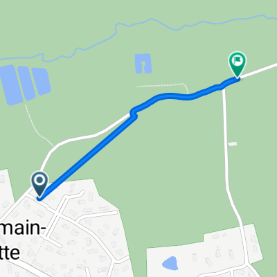
C050-Saint-Romain-la-Motte-Saint-Maurice-sur-Loire
A cycling route starting in Saint-Romain-la-Motte, Auvergne-Rhône-Alpes, France.
Overview
About this route
- -:--
- Duration
- 24.4 km
- Distance
- 508 m
- Ascent
- 479 m
- Descent
- ---
- Avg. speed
- ---
- Max. altitude
Route quality
Waytypes & surfaces along the route
Waytypes
Quiet road
16.6 km
(68 %)
Road
2.7 km
(11 %)
Surfaces
Paved
13.4 km
(55 %)
Unpaved
3.9 km
(16 %)
Asphalt
13.4 km
(55 %)
Gravel
3.7 km
(15 %)
Continue with Bikemap
Use, edit, or download this cycling route
You would like to ride C050-Saint-Romain-la-Motte-Saint-Maurice-sur-Loire or customize it for your own trip? Here is what you can do with this Bikemap route:
Free features
- Save this route as favorite or in collections
- Copy & plan your own version of this route
- Sync your route with Garmin or Wahoo
Premium features
Free trial for 3 days, or one-time payment. More about Bikemap Premium.
- Navigate this route on iOS & Android
- Export a GPX / KML file of this route
- Create your custom printout (try it for free)
- Download this route for offline navigation
Discover more Premium features.
Get Bikemap PremiumFrom our community
Other popular routes starting in Saint-Romain-la-Motte
 De Montée du Gros Chêne, Saint-Romain-la-Motte à Montée du Gros Chêne, Saint-Romain-la-Motte
- Distance
- 0.6 km
- Ascent
- 13 m
- Descent
- 0 m
- Location
- Saint-Romain-la-Motte, Auvergne-Rhône-Alpes, France
 De 61 Rue du Lavoir, Saint-Romain-la-Motte à 368–1074 Route de Riorges, Saint-Romain-la-Motte
- Distance
- 2.7 km
- Ascent
- 24 m
- Descent
- 20 m
- Location
- Saint-Romain-la-Motte, Auvergne-Rhône-Alpes, France
 Itinéraire facile en Roanne
- Distance
- 10 km
- Ascent
- 58 m
- Descent
- 57 m
- Location
- Saint-Romain-la-Motte, Auvergne-Rhône-Alpes, France
 De Rue du Stade à Les Grands Champs
- Distance
- 101.9 km
- Ascent
- 1,310 m
- Descent
- 946 m
- Location
- Saint-Romain-la-Motte, Auvergne-Rhône-Alpes, France
 C050-Saint-Romain-la-Motte-Saint-Maurice-sur-Loire
- Distance
- 24.4 km
- Ascent
- 508 m
- Descent
- 479 m
- Location
- Saint-Romain-la-Motte, Auvergne-Rhône-Alpes, France
 De Rue du Stade à Chemin du Moulin
- Distance
- 1 km
- Ascent
- 0 m
- Descent
- 4 m
- Location
- Saint-Romain-la-Motte, Auvergne-Rhône-Alpes, France
Open it in the app