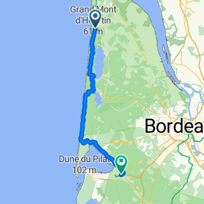
Hourtin - Andernos-les-Bains
- 55 km
- 88 m
- 101 m
- Hourtin, Nouvelle-Aquitaine, France
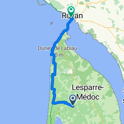
Tour de la Gironde
A cycling route starting in Hourtin, Nouvelle-Aquitaine, France.
Overview
created this 5 years ago
Part of
12 stages
Route quality
Cycleway
32 km
(83 %)
Quiet road
3.9 km
(10 %)
Paved
31.3 km
(81 %)
Unpaved
3.1 km
(8 %)
Asphalt
24.7 km
(64 %)
Paved (undefined)
6.6 km
(17 %)
Route highlights
Aire Naturelle de Camping les Grand Chênes et les Ajoncs 15 route des Lacs 33990 Naujac-sur-Mer 06 79 89 36 45
4 campings tres proches
Camping Mussonville
Continue with Bikemap
You would like to ride TDG Étape 9 : Hourtin / Soulac sur Mer or customize it for your own trip? Here is what you can do with this Bikemap route:
Free trial for 3 days, or one-time payment. More about Bikemap Premium.
Discover more Premium features.
Get Bikemap PremiumFrom our community
Open it in the app