

Ffm-Zeilsheim zum Airport
A cycling route starting in Kriftel, Hesse, Germany.
Overview
About this route
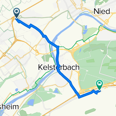
Der beste Weg von Frankfurt-Zeilsheim (Steinkopfweg) zum Frankfurter Flughafen.
Achtung: Die Straße entlang des Industrieparks Höchst ist zur Zeit teilweise gesperrt. Umleitung über Lachgraben möglich, die Farbwerksbrücke kann genutzt werden
- -:--
- Duration
- 9.9 km
- Distance
- 29 m
- Ascent
- 26 m
- Descent
- ---
- Avg. speed
- ---
- Max. altitude
Continue with Bikemap
Use, edit, or download this cycling route
You would like to ride Ffm-Zeilsheim zum Airport or customize it for your own trip? Here is what you can do with this Bikemap route:
Free features
- Save this route as favorite or in collections
- Copy & plan your own version of this route
- Sync your route with Garmin or Wahoo
Premium features
Free trial for 3 days, or one-time payment. More about Bikemap Premium.
- Navigate this route on iOS & Android
- Export a GPX / KML file of this route
- Create your custom printout (try it for free)
- Download this route for offline navigation
Discover more Premium features.
Get Bikemap PremiumFrom our community
Other popular routes starting in Kriftel
 Zeilsheim - Sachsenhausen
- Distance
- 14.4 km
- Ascent
- 23 m
- Descent
- 39 m
- Location
- Kriftel, Hesse, Germany
 Rund um den Kaisertempel
- Distance
- 26.3 km
- Ascent
- 513 m
- Descent
- 513 m
- Location
- Kriftel, Hesse, Germany
 Permanente RTF - RV Sossenheim
- Distance
- 73.8 km
- Ascent
- 389 m
- Descent
- 389 m
- Location
- Kriftel, Hesse, Germany
 Kriftel - Zum goldenen Anker - Rosarium - Kriftel
- Distance
- 11.2 km
- Ascent
- 29 m
- Descent
- 29 m
- Location
- Kriftel, Hesse, Germany
 Ffm-Zeilsheim zum Airport
- Distance
- 9.9 km
- Ascent
- 29 m
- Descent
- 26 m
- Location
- Kriftel, Hesse, Germany
 Maul halten! Dann besorg ichs mir alleine!
- Distance
- 16.3 km
- Ascent
- 237 m
- Descent
- 234 m
- Location
- Kriftel, Hesse, Germany
 Ffm-Zeilsheim zur Viehweide
- Distance
- 3.9 km
- Ascent
- 121 m
- Descent
- 4 m
- Location
- Kriftel, Hesse, Germany
 1.MTB-Runde
- Distance
- 25.6 km
- Ascent
- 451 m
- Descent
- 438 m
- Location
- Kriftel, Hesse, Germany
Open it in the app