

MTB-MAREMMAontheRoad-Bike Family
4 - MTB - Bike Family - Black - Ghirlanda - Pian dei Mucini - Monte Arsenti - Marsiliana - Ghirlanda
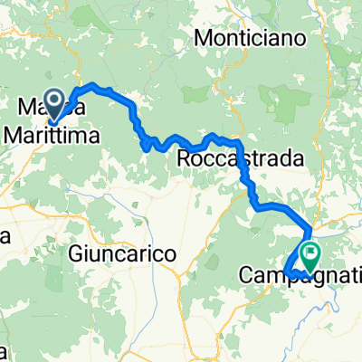
A cycling route starting in Massa Marittima, Tuscany, Italy.
Overview
About this route
One of the many ways to travel the Maremma on the Road Trail Area !!
- -:--
- Duration
- 34.4 km
- Distance
- 459 m
- Ascent
- 459 m
- Descent
- ---
- Avg. speed
- ---
- Max. altitude

Part of
8 stages
Route photos

Route quality
Waytypes & surfaces along the route
Waytypes
Track
12.7 km
(37 %)
Quiet road
12.1 km
(35 %)
Surfaces
Paved
14.5 km
(42 %)
Unpaved
17.9 km
(52 %)
Gravel
14.8 km
(43 %)
Asphalt
14.5 km
(42 %)
Route highlights
Points of interest along the route
Drinking water after 0.1 km
Fonte del Tordino
Point of interest after 0.1 km
Alimentari e Ristorante Trattoria Da Sbrana
Accommodation after 6.5 km
Hotel Pian dei Mucini
Accommodation after 6.5 km
Agriturismo Belvedere
Point of interest after 9.3 km
Cava della Rena Area Pic Nic

Drinking water after 10.6 km
The Trail Brothers Point
Photo after 13.4 km
Geotermic City of Monterotondo

Photo after 17.8 km
Accommodation after 28.7 km
Podere Acquarello
Accommodation after 28.8 km
Podere Schiacciaghiande Bar e Bike Services
Point of interest after 30.6 km
Mulimpresso Istori point
Accommodation after 30.7 km
Agriturismo il Vecchio Imposto
Drinking water after 30.7 km
Ristorante Villa la Boccia
Accommodation after 31 km
Bike Hotel Massa Vecchia Bike Service
Accommodation after 32.4 km
Agriresort La Colombaia
Accommodation after 32.9 km
Agriturismo bike Hotel Podere Giarlinga Bike Service Restaurant
Drinking water after 33 km
Bike service after 33.2 km
Continue with Bikemap
Use, edit, or download this cycling route
You would like to ride 4 - MTB - Bike Family - Black - Ghirlanda - Pian dei Mucini - Monte Arsenti - Marsiliana - Ghirlanda or customize it for your own trip? Here is what you can do with this Bikemap route:
Free features
- Save this route as favorite or in collections
- Copy & plan your own version of this route
- Sync your route with Garmin or Wahoo
Premium features
Free trial for 3 days, or one-time payment. More about Bikemap Premium.
- Navigate this route on iOS & Android
- Export a GPX / KML file of this route
- Create your custom printout (try it for free)
- Download this route for offline navigation
Discover more Premium features.
Get Bikemap PremiumFrom our community
Other popular routes starting in Massa Marittima
 MTB 14 km La Pesta Singletrails
- Distance
- 14.7 km
- Ascent
- 352 m
- Descent
- 352 m
- Location
- Massa Marittima, Tuscany, Italy
 Massa-Marittima Cicalino
- Distance
- 117 km
- Ascent
- 1,444 m
- Descent
- 1,388 m
- Location
- Massa Marittima, Tuscany, Italy
 toscana
- Distance
- 31.5 km
- Ascent
- 362 m
- Descent
- 359 m
- Location
- Massa Marittima, Tuscany, Italy
 MTB 31 km HalbtagestourMaremma
- Distance
- 31.2 km
- Ascent
- 438 m
- Descent
- 438 m
- Location
- Massa Marittima, Tuscany, Italy
 6 - MTB - Bike Family - Green - Tour Pianizzoli
- Distance
- 17.3 km
- Ascent
- 126 m
- Descent
- 124 m
- Location
- Massa Marittima, Tuscany, Italy
 7 - MTB - Cross Country - Green/Blue - Tour Massa Marittima
- Distance
- 25.7 km
- Ascent
- 339 m
- Descent
- 338 m
- Location
- Massa Marittima, Tuscany, Italy
 Massa Marittima Maggio to Via Sant'Agata
- Distance
- 67.3 km
- Ascent
- 1,933 m
- Descent
- 2,117 m
- Location
- Massa Marittima, Tuscany, Italy
 4 - MTB - Cross Country - Gavorrano - Green -
- Distance
- 27.2 km
- Ascent
- 420 m
- Descent
- 420 m
- Location
- Massa Marittima, Tuscany, Italy
Open it in the app