

Ber-Cube
A cycling route starting in Westend, State of Berlin, Germany.
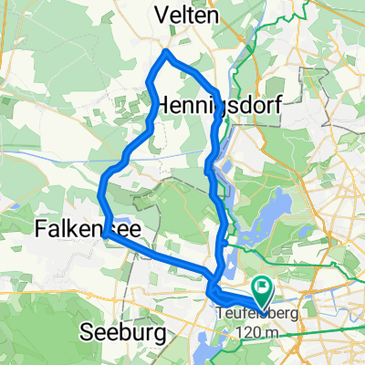
Overview
About this route
- -:--
- Duration
- 379.2 km
- Distance
- 5,016 m
- Ascent
- 4,484 m
- Descent
- ---
- Avg. speed
- ---
- Max. altitude

Route quality
Waytypes & surfaces along the route
Waytypes
Road
138.4 km
(37 %)
Busy road
91.1 km
(24 %)
Surfaces
Paved
270.3 km
(71 %)
Unpaved
19.9 km
(5 %)
Asphalt
241.1 km
(64 %)
Paving stones
16.2 km
(4 %)
Route highlights
Points of interest along the route
Point of interest after 97 km
Supermarkt
Point of interest after 107.6 km
Supermarkt
Point of interest after 110 km
UNESCO Welterbe Stadt- und Pfarrkirche St. Marien
Point of interest after 110.2 km
Lutherdenkmal
Point of interest after 155.6 km
Supermarkt
Point of interest after 194.9 km
1. Verpflegungsposten
Point of interest after 288 km
Tankstelle mit Shop?
Point of interest after 292.8 km
Supermarkt
Point of interest after 308.4 km
24 Stunden Tankstelle mit Shop Zwischen 22 und 6 Uhr Nachtschalter!
Continue with Bikemap
Use, edit, or download this cycling route
You would like to ride Ber-Cube or customize it for your own trip? Here is what you can do with this Bikemap route:
Free features
- Save this route as favorite or in collections
- Copy & plan your own version of this route
- Split it into stages to create a multi-day tour
- Sync your route with Garmin or Wahoo
Premium features
Free trial for 3 days, or one-time payment. More about Bikemap Premium.
- Navigate this route on iOS & Android
- Export a GPX / KML file of this route
- Create your custom printout (try it for free)
- Download this route for offline navigation
Discover more Premium features.
Get Bikemap PremiumFrom our community
Other popular routes starting in Westend
 Tannenbergallee 12, Берлин до Charlottenburg-Wilmersdorf, Берлин
- Distance
- 9.5 km
- Ascent
- 169 m
- Descent
- 169 m
- Location
- Westend, State of Berlin, Germany
 Der Alt-Berliner-Klassiker
- Distance
- 45.2 km
- Ascent
- 269 m
- Descent
- 269 m
- Location
- Westend, State of Berlin, Germany
 Berlin Havel-Rundtour mit Spandau
- Distance
- 47.9 km
- Ascent
- 251 m
- Descent
- 251 m
- Location
- Westend, State of Berlin, Germany
 Sacrower Runde
- Distance
- 56.2 km
- Ascent
- 326 m
- Descent
- 326 m
- Location
- Westend, State of Berlin, Germany
 50 Km Spandau - Schönheide - Tegel - Spandau
- Distance
- 49.6 km
- Ascent
- 89 m
- Descent
- 99 m
- Location
- Westend, State of Berlin, Germany
 Sacrow Runde
- Distance
- 67.7 km
- Ascent
- 146 m
- Descent
- 161 m
- Location
- Westend, State of Berlin, Germany
 perm Havel auf, Havel ab
- Distance
- 73 km
- Ascent
- 474 m
- Descent
- 498 m
- Location
- Westend, State of Berlin, Germany
 RTF Rund um Berlin 2013
- Distance
- 217.1 km
- Ascent
- 526 m
- Descent
- 548 m
- Location
- Westend, State of Berlin, Germany
Open it in the app