Toscana : Saturnia
- 63.2 km
- 693 m
- 1,375 m
- Abbadia San Salvatore, Tuscany, Italy
A cycling route starting in Abbadia San Salvatore, Tuscany, Italy.
Overview
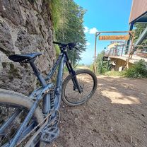
The ROUTE is truly the highlight of the event: a loop of about 5500 meters and over 200 meters of elevation gain, surrounded by paths through beautiful beech forests and green chestnut groves, but also exciting passages in ancient and historic estates as well as the transit through the village of Vivo with the difficult section on the mycological path.
PROGRAM 2010
Friday, June 25 In the morning, arrival of the first teams, accommodation in the campus areas set up in the village of Vivo.. At 5:30 PM and until sunset, a fabulous bike tour to the sources of Vivo located at an altitude of 1109 meters. At the end, Polenta del Boscaiolo and a giant screen to watch the World Cup.
Saturday, June 26 At 8:00 AM, the start of the delivery of numbers and race packs. At 9:30 AM, exhibition of the Recreational Vehicle Roller Team specially made for athletes. At 11:00 AM, opening of the pasta party, non-stop for 24 hours. At 11:30 AM, briefing with team captains. At 12:00 PM, start of the 24h of Val d'Orcia. At 9:00 PM for dinner…. grilled meats! At 10:00 PM, Rock music concert.
Sunday, June 27 In the morning, a typical market for organic products from Val d’Orcia. At 12:00 PM, arrival of the 24H of Val d'Orcia. At 1:00 PM, closure of the pasta party. At 1:30 PM, awards ceremony.
created this 15 years ago
Continue with Bikemap
You would like to ride 24 ORE Val d'Orcia or customize it for your own trip? Here is what you can do with this Bikemap route:
Free trial for 3 days, or one-time payment. More about Bikemap Premium.
Discover more Premium features.
Get Bikemap PremiumFrom our community
Open it in the app