

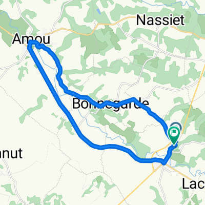
Jakobsweg 18. Etappe
A cycling route starting in Amou, Nouvelle-Aquitaine, France.
Overview
About this route
- -:--
- Duration
- 80.7 km
- Distance
- 676 m
- Ascent
- 523 m
- Descent
- ---
- Avg. speed
- ---
- Max. altitude

Route quality
Waytypes & surfaces along the route
Waytypes
Busy road
32.1 km
(40 %)
Road
22.7 km
(28 %)
Surfaces
Paved
34.9 km
(43 %)
Unpaved
1.2 km
(2 %)
Asphalt
34.9 km
(43 %)
Gravel
1.2 km
(2 %)
Undefined
44.6 km
(55 %)
Continue with Bikemap
Use, edit, or download this cycling route
You would like to ride Jakobsweg 18. Etappe or customize it for your own trip? Here is what you can do with this Bikemap route:
Free features
- Save this route as favorite or in collections
- Copy & plan your own version of this route
- Split it into stages to create a multi-day tour
- Sync your route with Garmin or Wahoo
Premium features
Free trial for 3 days, or one-time payment. More about Bikemap Premium.
- Navigate this route on iOS & Android
- Export a GPX / KML file of this route
- Create your custom printout (try it for free)
- Download this route for offline navigation
Discover more Premium features.
Get Bikemap PremiumFrom our community
Other popular routes starting in Amou
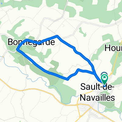
 sault de navailles
- Distance
- 19.4 km
- Ascent
- 73 m
- Descent
- 59 m
- Location
- Amou, Nouvelle-Aquitaine, France
 De Chemin de Mousquero À Arnaudet, Amou à Promenade de la Pomade 110, Montaut
- Distance
- 24 km
- Ascent
- 320 m
- Descent
- 293 m
- Location
- Amou, Nouvelle-Aquitaine, France
 De Rue de France à Rue de France
- Distance
- 18.9 km
- Ascent
- 60 m
- Descent
- 112 m
- Location
- Amou, Nouvelle-Aquitaine, France
 De Rue de France à Rue de France
- Distance
- 9.1 km
- Ascent
- 67 m
- Descent
- 122 m
- Location
- Amou, Nouvelle-Aquitaine, France
 De Rue de France à Rue de France
- Distance
- 19.5 km
- Ascent
- 102 m
- Descent
- 178 m
- Location
- Amou, Nouvelle-Aquitaine, France
 De 173 Chemin de Lapouble, Arsague à 133 Avenue de la Digue, Amou
- Distance
- 14.1 km
- Ascent
- 32 m
- Descent
- 71 m
- Location
- Amou, Nouvelle-Aquitaine, France
 De Route de Beyries 800, Sault-de-Navailles à Rue du Parvis 6, Lescar
- Distance
- 41.2 km
- Ascent
- 505 m
- Descent
- 472 m
- Location
- Amou, Nouvelle-Aquitaine, France
 De Rue Saint-Pierre 8, Amou à Rue Saint-Pierre 8, Amou
- Distance
- 6.9 km
- Ascent
- 6,849 m
- Descent
- 0 m
- Location
- Amou, Nouvelle-Aquitaine, France
Open it in the app