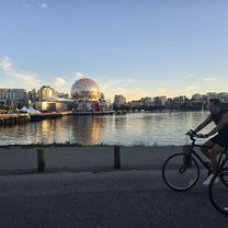
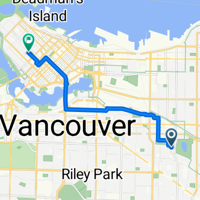
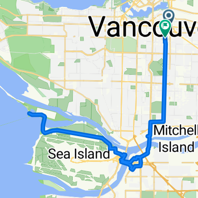
Crossing Canada part 1 - 2015
A cycling route starting in Vancouver, British Columbia, Canada.
Overview
About this route
Vancouver - Port Hardy
- -:--
- Duration
- 557 km
- Distance
- 6,451 m
- Ascent
- 6,496 m
- Descent
- ---
- Avg. speed
- ---
- Avg. speed
Continue with Bikemap
Use, edit, or download this cycling route
You would like to ride Crossing Canada part 1 - 2015 or customize it for your own trip? Here is what you can do with this Bikemap route:
Free features
- Save this route as favorite or in collections
- Copy & plan your own version of this route
- Sync your route with Garmin or Wahoo
Premium features
Free trial for 3 days, or one-time payment. More about Bikemap Premium.
- Navigate this route on iOS & Android
- Export a GPX / KML file of this route
- Create your custom printout (try it for free)
- Download this route for offline navigation
Discover more Premium features.
Get Bikemap PremiumFrom our community
Other popular routes starting in Vancouver
- Route to Jericho beach
- Distance
- 11.9 km
- Ascent
- 64 m
- Descent
- 139 m
- Location
- Vancouver, British Columbia, Canada
- UBC-Queen Elizabeth Park
- Distance
- 38.2 km
- Ascent
- 305 m
- Descent
- 306 m
- Location
- Vancouver, British Columbia, Canada
- Short bike tour from May 11, 14:45
- Distance
- 7.4 km
- Ascent
- 50 m
- Descent
- 53 m
- Location
- Vancouver, British Columbia, Canada
- 100 K Loop
- Distance
- 108.1 km
- Ascent
- 333 m
- Descent
- 335 m
- Location
- Vancouver, British Columbia, Canada
- Crown-UBC-4th Ave Hill circuit
- Distance
- 24.8 km
- Ascent
- 235 m
- Descent
- 236 m
- Location
- Vancouver, British Columbia, Canada
- Parkway/Greenway Loop
- Distance
- 38.7 km
- Ascent
- 391 m
- Descent
- 391 m
- Location
- Vancouver, British Columbia, Canada
- 40k UBC cw
- Distance
- 39.4 km
- Ascent
- 402 m
- Descent
- 405 m
- Location
- Vancouver, British Columbia, Canada
- 34k UBC cw
- Distance
- 34.1 km
- Ascent
- 357 m
- Descent
- 360 m
- Location
- Vancouver, British Columbia, Canada
Open it in the app