

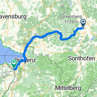
Allgäu - eine Route zum Geniessen
A cycling route starting in Kempten (Allgäu), Bavaria, Germany.
Overview
About this route
We are looking forward to a cycling tour through the pre-Alpine landscape of Allgäu, from Oberstaufen to Lindau. We touch on the center of the Nagelfluhkette Nature Park with Hochgrat as the highest elevation. Next, we cross the border into Austria and finally to Lindau, the destination of the tour. (Tour description at: thod_er@gmx.de)
- -:--
- Duration
- 62.2 km
- Distance
- 797 m
- Ascent
- 797 m
- Descent
- ---
- Avg. speed
- ---
- Max. altitude
Route quality
Waytypes & surfaces along the route
Waytypes
Quiet road
39.8 km
(64 %)
Path
9.3 km
(15 %)
Surfaces
Paved
41.7 km
(67 %)
Unpaved
0.6 km
(1 %)
Asphalt
41.7 km
(67 %)
Gravel
0.6 km
(1 %)
Undefined
19.9 km
(32 %)
Continue with Bikemap
Use, edit, or download this cycling route
You would like to ride Allgäu - eine Route zum Geniessen or customize it for your own trip? Here is what you can do with this Bikemap route:
Free features
- Save this route as favorite or in collections
- Copy & plan your own version of this route
- Sync your route with Garmin or Wahoo
Premium features
Free trial for 3 days, or one-time payment. More about Bikemap Premium.
- Navigate this route on iOS & Android
- Export a GPX / KML file of this route
- Create your custom printout (try it for free)
- Download this route for offline navigation
Discover more Premium features.
Get Bikemap PremiumFrom our community
Other popular routes starting in Kempten (Allgäu)
 Kempten Nordwest
- Distance
- 29.2 km
- Ascent
- 417 m
- Descent
- 425 m
- Location
- Kempten (Allgäu), Bavaria, Germany
 Kempten Süd Runde - Sonthofen
- Distance
- 69.5 km
- Ascent
- 774 m
- Descent
- 775 m
- Location
- Kempten (Allgäu), Bavaria, Germany
 Allgäu - eine Route zum Geniessen
- Distance
- 62.2 km
- Ascent
- 797 m
- Descent
- 797 m
- Location
- Kempten (Allgäu), Bavaria, Germany
 Steufzgen nach Johannes-Brasselstrasse
- Distance
- 86.5 km
- Ascent
- 797 m
- Descent
- 1,123 m
- Location
- Kempten (Allgäu), Bavaria, Germany
 Trainingsrunde
- Distance
- 41.5 km
- Ascent
- 750 m
- Descent
- 754 m
- Location
- Kempten (Allgäu), Bavaria, Germany
 1x um Kempten rum
- Distance
- 43.6 km
- Ascent
- 533 m
- Descent
- 498 m
- Location
- Kempten (Allgäu), Bavaria, Germany
 kleine Abendrunde Kempten - Martinszell
- Distance
- 30.3 km
- Ascent
- 185 m
- Descent
- 186 m
- Location
- Kempten (Allgäu), Bavaria, Germany
 Allgäu-Allgäu Mitte pur
- Distance
- 73.2 km
- Ascent
- 1,480 m
- Descent
- 1,475 m
- Location
- Kempten (Allgäu), Bavaria, Germany
Open it in the app