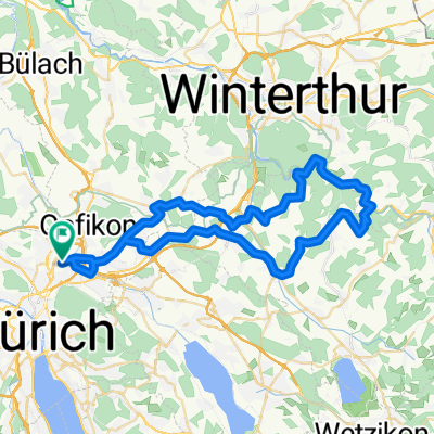
Beautiful lake cycle.....
- 29.1 km
- 32 m
- 31 m
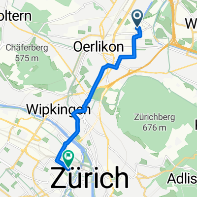
- Zürich (Kreis 12) / Saatlen, Canton of Zurich, Switzerland
A cycling route starting in Zürich (Kreis 12) / Saatlen, Canton of Zurich, Switzerland.
Overview
Route very mountainous and partly very steep partly also with stairs sparsely trafficked
created this 17 years ago
Route quality
Quiet road
3.8 km
(47 %)
Road
2.2 km
(27 %)
Paved
7.8 km
(97 %)
Asphalt
7.8 km
(97 %)
Undefined
0.2 km
(3 %)
Route highlights
Start/Ziel
Ziel / Start
Continue with Bikemap
You would like to ride zurUBS_viaEuropabrücke or customize it for your own trip? Here is what you can do with this Bikemap route:
Free trial for 3 days, or one-time payment. More about Bikemap Premium.
Discover more Premium features.
Get Bikemap PremiumFrom our community
Open it in the app